Geolokalisieren

Topografische Karte Essex

Klicken Sie auf die Karte, um die Höhe anzuzeigen.

Über diese Karte

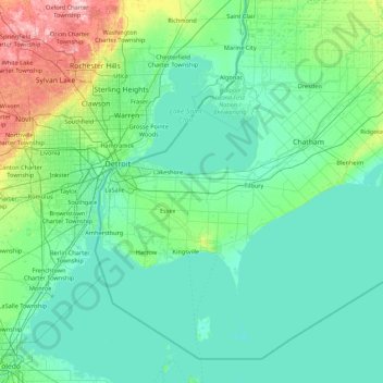
Name: Topografische Karte Essex, Höhe, Relief.

Ort: Essex, Ontario, N0R 1V0, Canada (41.59541 -83.35201 42.87541 -82.07201)

Durchschnittliche Höhe: 193 m

Minimale Höhe: 168 m

Maximale Höhe: 373 m

👉 Easily get elevation data in JSON, GeoTIFF and KML formats using Elevation API
Vielen Dank für die Unterstützung dieser Website ❤️
Spenden

Andere topografische Karten

Klicken Sie auf eine Karte, um ihre Topografie, ihre Höhe und ihr Relief anzuzeigen.

Ottawa

Canada > Ontario

Ottawa, the capital city of Canada, is situated on the south bank of the Ottawa River at the confluence with the Rideau River. The city's topography is characterized by gently rolling terrain with elevations ranging from approximately 44 meters (144 feet) above sea level at the Ottawa River to its highest…

Durchschnittliche Höhe: 105 m

Greater Sudbury

Canada > Ontario > Sudbury District

Durchschnittliche Höhe: 305 m

Southwestern Ontario

Canada > Ontario

Durchschnittliche Höhe: 235 m

North Bay

Canada > Ontario > Nipissing District

The climate in North Bay is common to most places in Northern Ontario. North Bay tends to be a less humid climate than that found in Southern Ontario due somewhat to the distance from the Great Lakes and less warm than some other locations in Northern Ontario due to cooling from Lake Nipissing. On May 31,…

Durchschnittliche Höhe: 266 m

Vielen Dank für die Unterstützung dieser Website ❤️
Spenden

Mississauga

Canada > Ontario > Peel Region

The shoreline of former Glacial Lake Iroquois roughly follows the Dundas Street alignment, although it is not noticeable in some places but is more prominent in others, such as the site of the former brickyard (Shoreline Dr. near Mavis Rd.), the ancient shoreline promenteau affords a clear view of downtown…

Durchschnittliche Höhe: 151 m

Toronto

Canada > Ontario

Despite its deep ravines, Toronto is not remarkably hilly, but its elevation does increase steadily away from the lake. Elevation differences range from 76.5 metres (251 ft) above sea level at the Lake Ontario shore to 209 m (686 ft) above sea level near the York University grounds in the city's north end at…

Durchschnittliche Höhe: 139 m

Thunder Bay

Canada > Ontario > Thunder Bay District

Durchschnittliche Höhe: 240 m

Barrie

Canada > Ontario > Barrie

Durchschnittliche Höhe: 248 m

Vielen Dank für die Unterstützung dieser Website ❤️
Spenden

Oakville

Canada > Ontario > Halton Region

Durchschnittliche Höhe: 104 m

Lake Ontario

Canada > Ontario

Lake Ontario is the easternmost of the Great Lakes and the smallest in surface area (7,340 sq mi, 18,960 km2), although it exceeds Lake Erie in volume (393 cu mi, 1,639 km3). It is the 13th largest lake in the world. When its islands are included, the lake's shoreline is 712 miles (1,146 km) long. As the last…

Durchschnittliche Höhe: 214 m

Manitoulin Island

Canada > Ontario > Manitoulin District

Durchschnittliche Höhe: 194 m

Vaughan

Canada > Ontario > York Region

Durchschnittliche Höhe: 220 m

Vielen Dank für die Unterstützung dieser Website ❤️
Spenden

Rüsten Sie sich für Ihr nächstes Abenteuer:

Als Amazon-Partner erhält diese Website eine Provision für qualifizierte Käufe, ohne zusätzliche Kosten für Sie.

Vaughan

Canada > Ontario > York Region

Durchschnittliche Höhe: 220 m

North Maple Regional Park

Canada > Ontario > York Region > Vaughan

Durchschnittliche Höhe: 274 m

Kitchener

Canada > Ontario > Region of Waterloo

Kitchener is located in Southwestern Ontario, in the Saint Lawrence Lowlands. This geological and climatic region has wet-climate soils and deciduous forests. Situated in the Grand River Valley, the area is generally above 300 m (1,000 ft) in elevation.

Durchschnittliche Höhe: 336 m

Faraday

Canada > Ontario > Hastings County

Durchschnittliche Höhe: 374 m

Burlington

Canada > Ontario > Halton Region

Durchschnittliche Höhe: 141 m

Waterloo

Canada > Ontario > Region of Waterloo

Durchschnittliche Höhe: 341 m

Algonquin Provincial Park

Canada > Ontario

Durchschnittliche Höhe: 386 m

Penetanguishene

Canada > Ontario > Simcoe County

Durchschnittliche Höhe: 216 m

Vielen Dank für die Unterstützung dieser Website ❤️
Spenden

Rüsten Sie sich für Ihr nächstes Abenteuer:

Als Amazon-Partner erhält diese Website eine Provision für qualifizierte Käufe, ohne zusätzliche Kosten für Sie.

Niagara Falls

Canada > Ontario > Niagara Region

Durchschnittliche Höhe: 179 m

Oshawa

Canada > Ontario > Durham Region

Durchschnittliche Höhe: 167 m

Milton

Canada > Ontario > Halton Region

Durchschnittliche Höhe: 237 m

Sarnia

Canada > Ontario > Lambton County

Sarnia is located on the eastern shore of Lake Huron at its extreme southern point, where it flows into the St. Clair River. Most of the surrounding area is flat, and the elevation ranges from 169 metres (554 ft) and 281 metres (922 ft) above sea level. The soil mostly comprises clay. Despite this high…

Durchschnittliche Höhe: 186 m

Brampton

Canada > Ontario > Peel Region

Durchschnittliche Höhe: 223 m

Hamilton

Canada > Ontario

The airport's open, rural location and higher altitude results in lower temperatures, generally windier conditions, and higher snowfall amounts than lower, built-up areas of the city. The highest temperature ever recorded in Hamilton was 41.1 °C (106 °F) on July 14, 1868. The coldest temperature ever…

Durchschnittliche Höhe: 187 m

Puslinch

Canada > Ontario > Wellington County

Durchschnittliche Höhe: 317 m

Renfrew County

Canada > Ontario

Durchschnittliche Höhe: 283 m

Haldimand County

Canada > Ontario

Durchschnittliche Höhe: 190 m

Hamilton

Canada > Ontario

Hamilton's climate is humid-continental, characterized by changeable weather patterns. In the Köppen classification, Hamilton it is on the Dfb/Dfa border found in southern Ontario because the average temperature in July is 22.0 °C (71.6 °F). However, its climate is moderate compared with most of Canada. The…

Durchschnittliche Höhe: 187 m

Niagara Region

Canada > Ontario

Durchschnittliche Höhe: 148 m

Essex County

Canada > Ontario

Durchschnittliche Höhe: 178 m

Eastern Ontario

Canada > Ontario

Along the extreme western edge of Eastern Ontario is a continuation of the Laurentian Highlands, known as the Opeongo Hills, and they contain some of the highest elevations in Southern Ontario. They stretch into the northern portions of Central Ontario, near Algonquin Provincial Park.

Durchschnittliche Höhe: 243 m

Prince Edward County

Canada > Ontario

Durchschnittliche Höhe: 96 m

Northwestern Ontario

Canada > Ontario

Durchschnittliche Höhe: 221 m

Timmins

Canada > Ontario > Cochrane District

Durchschnittliche Höhe: 302 m

Vielen Dank für die Unterstützung dieser Website ❤️
Spenden

Wasaga Beach

Canada > Ontario > Simcoe County

The Town of Wasaga Beach covers an area of 61.13 square kilometres (23.60 sq mi) comprised predominantly of sand and loamy sand that exhibit excessive to good drainage and irregular to moderately sloping topography. The poor soil quality makes it difficult to sustain lush lawns in the town. The Canada Land…

Durchschnittliche Höhe: 190 m

Sudbury

Canada > Ontario > Greater Sudbury

Durchschnittliche Höhe: 272 m

Toronto

Canada > Ontario

Despite its deep ravines, Toronto is not remarkably hilly, but its elevation does increase steadily away from the lake. Elevation differences range from 76.5 metres (251 ft) above sea level at the Lake Ontario shore to 209 m (686 ft) ASL near the York University grounds in the city's north end at the…

Durchschnittliche Höhe: 139 m

Kingston

Canada > Ontario

Durchschnittliche Höhe: 112 m

North York

Canada > Ontario > Toronto

Durchschnittliche Höhe: 167 m

Quetico Provincial Park

Canada > Ontario

Durchschnittliche Höhe: 432 m

Chisholm Township

Canada > Ontario > Nipissing District

Durchschnittliche Höhe: 326 m

Richmond Hill

Canada > Ontario > York Region

The village of Richmond Hill was incorporated by a bylaw of the York County Council on June 18, 1872, coming into effect January 1, 1873. In September 1956, the Ontario Municipal Board approved its elevation to Town status, effective January 1, 1957.

Durchschnittliche Höhe: 256 m

Vielen Dank für die Unterstützung dieser Website ❤️
Spenden

Rüsten Sie sich für Ihr nächstes Abenteuer:

Als Amazon-Partner erhält diese Website eine Provision für qualifizierte Käufe, ohne zusätzliche Kosten für Sie.

Bancroft

Canada > Ontario > Hastings County

Durchschnittliche Höhe: 370 m

Collingwood

Canada > Ontario > Simcoe County

Durchschnittliche Höhe: 190 m

Fort Erie

Canada > Ontario > Niagara Region

Durchschnittliche Höhe: 182 m

Muskoka River

Canada > Ontario > Muskoka District > Bracebridge

Durchschnittliche Höhe: 246 m

Scarborough

Canada > Ontario > Toronto

Topographically, Scarborough is dominated by two watersheds, Highland Creek and the Rouge River. Highland Creek lies almost entirely within Scarborough and occupies approximately 70% of its total area. It occupies the western half of Scarborough, while the Rouge River flows through the eastern portion. Both of…

Durchschnittliche Höhe: 138 m

Ajax

Canada > Ontario > Durham Region

Durchschnittliche Höhe: 101 m

St. Catharines

Canada > Ontario > Niagara Region

The most defining transportation icon of St. Catharines is the Welland Canal, a ship canal that runs 43.4 kilometres (27.0 mi), passing through the city. Four of its locks are within city boundaries. The canal allows shipping vessels to traverse the 99.5-metre (326.5 ft) drop in altitude from Lake Erie to Lake…

Durchschnittliche Höhe: 103 m

Elliot Lake

Canada > Ontario > Algoma District

Durchschnittliche Höhe: 342 m

Vielen Dank für die Unterstützung dieser Website ❤️
Spenden

Rüsten Sie sich für Ihr nächstes Abenteuer:

Als Amazon-Partner erhält diese Website eine Provision für qualifizierte Käufe, ohne zusätzliche Kosten für Sie.

Pembroke

Canada > Ontario

Durchschnittliche Höhe: 128 m

Lake Nipissing

Canada > Ontario > Nipissing District

Lake Nipissing (/ˈnɪpəsɪŋ/; French: lac Nipissing, Ojibwe: Gichi-nibiinsing-zaaga’igan) is a lake in the Canadian province of Ontario. It has a surface area of 873.3 km2 (337.2 sq mi), a mean elevation of 196 m (643 ft) above sea level, and is located between the Ottawa River and Georgian Bay. Lake…

Durchschnittliche Höhe: 272 m

Etobicoke

Canada > Ontario > Toronto

Durchschnittliche Höhe: 145 m

Durham Region

Canada > Ontario

Durchschnittliche Höhe: 235 m

Niagara Escarpment

Canada > Ontario > Burlington

Durchschnittliche Höhe: 216 m

Guelph

Canada > Ontario

This region of Ontario has cold winters and warm, humid summers, falling into the Köppen climate classification Dfb zone (humid continental), with moderately high rainfall and snowfall. It is generally a couple of degrees cooler than lower elevation regions on the Great Lakes shorelines, especially so in…

Durchschnittliche Höhe: 335 m

Rice Lake

Canada > Ontario > Northumberland County > Hamilton Township

Durchschnittliche Höhe: 225 m

Norfolk County

Canada > Ontario

Durchschnittliche Höhe: 216 m

Vielen Dank für die Unterstützung dieser Website ❤️
Spenden

Rüsten Sie sich für Ihr nächstes Abenteuer:

Als Amazon-Partner erhält diese Website eine Provision für qualifizierte Käufe, ohne zusätzliche Kosten für Sie.

Humber River

Canada > Ontario > Toronto

Durchschnittliche Höhe: 82 m

Sault Ste. Marie

Canada > Ontario > Algoma District

Durchschnittliche Höhe: 249 m

Simcoe County

Canada > Ontario

The road network in Simcoe County is based on a grid pattern, with most roads running north–south or east–west. The topography of the land has permitted roads to be set in predominantly straight lines.

Durchschnittliche Höhe: 265 m

Port Colborne

Canada > Ontario > Niagara Region

Durchschnittliche Höhe: 177 m

Chatham-Kent

Canada > Ontario

Durchschnittliche Höhe: 183 m

York Region

Canada > Ontario

Durchschnittliche Höhe: 243 m

Niagara-on-the-Lake

Canada > Ontario > Niagara Region

Durchschnittliche Höhe: 108 m

Erin

Canada > Ontario > Wellington County

Durchschnittliche Höhe: 390 m

Arnprior

Canada > Ontario > Renfrew County

Arnprior is located on the Trans-Canada Highway system, where Highway 417 to the east becomes the two-lane Highway 17 to the west. The town is served by the Arnprior Airport, elevation 108 m (355 ft), and the nearby Arnprior Water Aerodrome, elevation 100 m (330 ft), for general aviation; although there is no…

Durchschnittliche Höhe: 93 m

Lambton County

Canada > Ontario

Durchschnittliche Höhe: 200 m

Algoma District

Canada > Ontario

Durchschnittliche Höhe: 305 m

High Park

Canada > Ontario > Toronto

Durchschnittliche Höhe: 97 m

Vielen Dank für die Unterstützung dieser Website ❤️
Spenden

Rüsten Sie sich für Ihr nächstes Abenteuer:

Als Amazon-Partner erhält diese Website eine Provision für qualifizierte Käufe, ohne zusätzliche Kosten für Sie.

London

Canada > Ontario

London has a humid continental climate (Köppen Dfb), though due to its downwind location relative to Lake Huron and elevation changes across the city, it is virtually on the Dfa/Dfb (hot summer) boundary favouring the former climate zone to the southwest of the confluence of the South and North Thames Rivers,…

Durchschnittliche Höhe: 263 m

Barrie

Canada > Ontario

On September 7, 1977, a private aircraft, flown by "Army" Hollingsworth, dropped altitude to 500 feet (152 m) in dense fog and struck CKVR's 1,000-foot (305 m) transmitter tower, killing all five people aboard the plane and destroying the tower and antenna. The station's 225-foot (69 m) auxiliary tower was…

Durchschnittliche Höhe: 265 m

Credit River

Canada > Ontario > Mississauga

Durchschnittliche Höhe: 251 m

Smiths Falls

Canada > Ontario

Durchschnittliche Höhe: 123 m

Hindon Lake

Canada > Ontario > Haliburton County > Algonquin Highlands

Durchschnittliche Höhe: 352 m

Thornhill

Canada > Ontario > York Region > Vaughan

Durchschnittliche Höhe: 206 m

Markham

Canada > Ontario > York Region

Markham's average altitude is at 200 m (660 ft) and in general consists of gently rolling hills. The city is intersected by two rivers; the Don River and Rouge River, as well as their tributaries. To the north is the Oak Ridges Moraine, which further elevates the elevation towards the north.

Durchschnittliche Höhe: 216 m

Newmarket

Canada > Ontario > York Region

Newmarket's geographical coordinates are 44.05°N, 79.46°W, and its elevation above sea level is 252 m. It has an area of 38.33 km². The town is bounded on the south by Aurora, on the west by King, on the north by East Gwillimbury and on the east by Whitchurch–Stouffville.

Durchschnittliche Höhe: 270 m

Pickering

Canada > Ontario > Durham Region

The city covers an area of 231 square kilometres (89 sq mi) with an elevation of 89 metres (292 ft).

Durchschnittliche Höhe: 170 m

Aurora

Canada > Ontario > York Region

Durchschnittliche Höhe: 291 m

Whitchurch-Stouffville

Canada > Ontario > York Region

Durchschnittliche Höhe: 295 m

Georgina

Canada > Ontario > York Region

Durchschnittliche Höhe: 231 m

Caledon

Canada > Ontario > Peel Region

Durchschnittliche Höhe: 331 m

Lanark County

Canada > Ontario

Durchschnittliche Höhe: 167 m

Thunder Bay District

Canada > Ontario

Durchschnittliche Höhe: 321 m

Vielen Dank für die Unterstützung dieser Website ❤️
Spenden

Rüsten Sie sich für Ihr nächstes Abenteuer:

Als Amazon-Partner erhält diese Website eine Provision für qualifizierte Käufe, ohne zusätzliche Kosten für Sie.

Grey County

Canada > Ontario

Durchschnittliche Höhe: 288 m

Muskoka District

Canada > Ontario

Durchschnittliche Höhe: 294 m

Sleeping Giant Provincial Park

Canada > Ontario

Durchschnittliche Höhe: 207 m

Vielen Dank für die Unterstützung dieser Website ❤️
Spenden

Rüsten Sie sich für Ihr nächstes Abenteuer:

Als Amazon-Partner erhält diese Website eine Provision für qualifizierte Käufe, ohne zusätzliche Kosten für Sie.

Orillia

Canada > Ontario

Durchschnittliche Höhe: 234 m

Peterborough

Canada > Ontario

Peterborough's topography is largely defined by land formations created by the receding Wisconsian glaciers 10,000–15,000 years ago. The South End and Downtown portions of the city sit on what was the bottom of the glacial Lake Peterborough—part of a glacial spillway created when glacial meltwaters from…

Durchschnittliche Höhe: 232 m

Grey Highlands

Canada > Ontario > Grey County

Durchschnittliche Höhe: 428 m

Niagara Escarpment

Canada > Ontario > Hamilton

Durchschnittliche Höhe: 162 m

Sudbury

Canada > Ontario > Sudbury District

Durchschnittliche Höhe: 277 m

Central Ontario

Canada > Ontario

Along the northern edge of Central Ontario, are some of the highest elevations in Southern Ontario. These highlands are known as the Opeongo Hills, and they stretch into portions of Eastern Ontario as well.

Durchschnittliche Höhe: 255 m

Rüsten Sie sich für Ihr nächstes Abenteuer:

🧣Rettungsdecken - Schutz vor Auskühlung in Notsituationen
📷Kamera-Rucksackhalterungen - Sicherer Zugriff auf die Kamera beim Wandern
🔥Camping-Gaskocher - Schnelle warme Mahlzeiten überall in der Natur
🥾Wanderschuhe für Herren - Robuste und bequeme Wanderschuhe für lange Trekkingtouren
Sportuhren mit Topo-Karten - High-End Multisportuhren mit integrierter Kartendarstellung

Als Amazon-Partner erhält diese Website eine Provision für qualifizierte Käufe, ohne zusätzliche Kosten für Sie.