
Topografische Karte Agolada
Interaktive Karte
Klicken Sie auf die Karte, um die Höhe anzuzeigen.
Über diese Karte
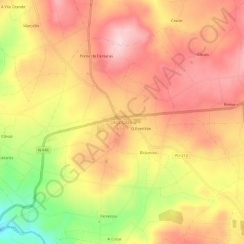
Name: Topografische Karte Agolada, Höhe, Relief.
Ort: Agolada, Deza, Pontevedra, Galicia, 36520, España (42.74259 -8.03842 42.78259 -7.99842)
Durchschnittliche Höhe: 569 m
Minimale Höhe: 418 m
Maximale Höhe: 660 m
Andere topografische Karten
Klicken Sie auf eine Karte, um ihre Topografie, ihre Höhe und ihr Relief anzuzeigen.
Pontenoufe
Pontenoufe, A Xesta, Lalín, Deza, Pontevedra, Galicia, 36515, España
Durchschnittliche Höhe: 567 m