
Topografische Karte Varna
Interaktive Karte
Klicken Sie auf die Karte, um die Höhe anzuzeigen.
Über diese Karte
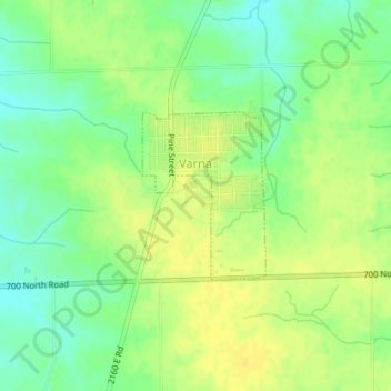
Name: Topografische Karte Varna, Höhe, Relief.
Ort: Varna, Marshall County, Illinois, United States (41.02841 -89.23107 41.03997 -89.21977)
Durchschnittliche Höhe: 220 m
Minimale Höhe: 207 m
Maximale Höhe: 229 m
Andere topografische Karten
Klicken Sie auf eine Karte, um ihre Topografie, ihre Höhe und ihr Relief anzuzeigen.
Wenona
United States > Illinois > Marshall County
Wenona, Marshall County, Illinois, 61377, United States
Durchschnittliche Höhe: 214 m
Marshall State Fish and Wildlife Area
United States > Illinois > Marshall County
Marshall State Fish and Wildlife Area, Marshall County, Illinois, United States
Durchschnittliche Höhe: 170 m
Hopewell
United States > Illinois > Marshall County
Hopewell, Marshall County, Illinois, United States
Durchschnittliche Höhe: 177 m
Lacon
United States > Illinois > Marshall County
Lacon, Marshall County, Illinois, United States
Durchschnittliche Höhe: 148 m