Geolokalisieren

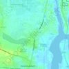
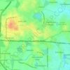
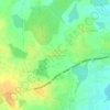
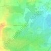
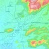
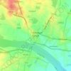
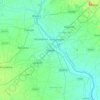
Topografische Karte Manachanallur

Klicken Sie auf die Karte, um die Höhe anzuzeigen.

Über diese Karte

Name: Topografische Karte Manachanallur, Höhe, Relief.

Ort: Manachanallur, Tiruchirappalli District, Tamil Nadu, India (10.86445 78.57827 11.12194 78.81603)

Durchschnittliche Höhe: 97 m

Minimale Höhe: 54 m

Maximale Höhe: 282 m

Andere topografische Karten

Klicken Sie auf eine Karte, um ihre Topografie, ihre Höhe und ihr Relief anzuzeigen.
The Nilgiris

India > Tamil Nadu

Durchschnittliche Höhe: 639 m

Padur

India > Tamil Nadu

Durchschnittliche Höhe: 5 m

Kaveri river

India > Tamil Nadu > Thanjavur

Durchschnittliche Höhe: 45 m

Buttercombai

India > Tamil Nadu > Udhagamandalam

Durchschnittliche Höhe: 2.295 m

Thanjavur

India > Tamil Nadu > Thanjavur

Thanjavur is located at 10°48′N 79°09′E / 10.8°N 79.15°E / 10.8; 79.15 The tributaries of river Cauvery, namely, the Grand Anaicut canal (Pudhaaru), Vadavaaru and Vennaaru rivers flow through the city. Thanjavur is situated in the Cauvery delta, at a distance of 314 km (195 mi) south-west of…

Durchschnittliche Höhe: 49 m
Pullambadi

India > Tamil Nadu > Lalgudi

Durchschnittliche Höhe: 63 m

Neyveli

India > Tamil Nadu > Virudhachalam

Neyveli is located at 11°36′N 79°29′E / 11.60°N 79.48°E / 11.60; 79.48. It has an average elevation of 87 metres (285 ft). It is located along with the Chennai-Thanjavur National Highway. Neyveli was a planned township and is sub-divided into 'blocks'. There are 32 blocks with each block…

Durchschnittliche Höhe: 23 m
Kanchipuram

India > Tamil Nadu

Kanchipuram is located at 12°50′19″N 79°42′06″E / 12.8387°N 79.7016°E / 12.8387; 79.7016, 72 km (45 mi) south-west of Chennai on the banks of the Vegavathi River, a tributary of the Palar River. The city covers an area of 11.6 km2 (4.5 sq mi) and has an elevation of 83.2 m (273 ft) above…

Durchschnittliche Höhe: 82 m
Coimbatore

India > Tamil Nadu > Coimbatore North

Durchschnittliche Höhe: 452 m

Avadi

India > Tamil Nadu > Avadi

Avadi is located at 13°07′N 80°06′E / 13.12°N 80.1°E / 13.12; 80.1. It covers an area of 65 square kilometres (25 sq mi) and has an average elevation of 17 metres (56 ft).

Durchschnittliche Höhe: 24 m

Cheyyar River

India > Tamil Nadu

Durchschnittliche Höhe: 181 m

Kosasthalaiyar River

India > Tamil Nadu > Uthukkottai > Arumbakkam

Durchschnittliche Höhe: 41 m

Sālavākkam

India > Tamil Nadu

Durchschnittliche Höhe: 37 m

Hosur

India > Tamil Nadu > Hosur

Hosur experiences a tropical savanna climate (Köppen climate classification) with distinct wet and dry seasons. Due to its high elevation, Hosur usually enjoys salubrious and moderate climate throughout the year, with occasional heat waves. The coolest month is January with an average low temperature of 17.1…

Durchschnittliche Höhe: 859 m

Tiruvannamalai

India > Tamil Nadu > Tiruvannamalai > Tiruvannamalai

Located on the foothills of Annamalai hills, Tiruvannamalai has been ruled by the Pallavas, the Medieval Cholas, the Later Cholas, Hoysalas, the Vijayanagar Empire, the Carnatic kingdom, Tipu Sultan, and the British. It served as the capital of the Hoysalas. The town is built around the Annamalaiyar Temple…

Durchschnittliche Höhe: 202 m
Thandikudi

India > Tamil Nadu > Kodaikanal

Durchschnittliche Höhe: 1.381 m

Noyyal River

India > Tamil Nadu > Coimbatore

Durchschnittliche Höhe: 463 m

Tirunelveli

India > Tamil Nadu > Palayamkottai

Tirunelveli is located at 8°43′41.82″N 77°41′43.94″E / 8.7282833°N 77.6955389°E / 8.7282833; 77.6955389, and its average elevation is 47 metres (154 ft). It is located at the southernmost tip of the Deccan plateau. The Tamirabarani River divides the city into the Tirunelveli quarter and…

Durchschnittliche Höhe: 34 m
Manimangalam

India > Tamil Nadu

Durchschnittliche Höhe: 21 m

Palar River

India > Tamil Nadu > Chengalpattu > Devanur

Durchschnittliche Höhe: 44 m

Budalur

India > Tamil Nadu > Thanjavur > Budalur

Durchschnittliche Höhe: 55 m

Sālavākkam

India > Tamil Nadu

Durchschnittliche Höhe: 37 m

Ramnathapuram

India > Tamil Nadu

Durchschnittliche Höhe: 59 m

Mannur

India > Tamil Nadu

Durchschnittliche Höhe: 49 m

Patta

India > Tamil Nadu

Durchschnittliche Höhe: 52 m

Pushpagiri

India > Tamil Nadu

Durchschnittliche Höhe: 28 m

Melakottaiyur

India > Tamil Nadu > Tiruporur

Durchschnittliche Höhe: 22 m

Pillaipakkam

India > Tamil Nadu

Durchschnittliche Höhe: 31 m

Singadivakkam

India > Tamil Nadu > Chennai Metropolitan Area

Durchschnittliche Höhe: 65 m

Dharapuram

India > Tamil Nadu > Dharapuram

Dharapuram is located at 10°44′N 77°31′E / 10.73°N 77.52°E / 10.73; 77.52. Dharapuram town is situated along of the bank of Amaravathi River which flows from the south to north. Uppar River and dam, Nallathankal River and dam, Palar join the river Amaravathi. It has an average elevation of 45…

Durchschnittliche Höhe: 256 m
Madurai

India > Tamil Nadu > Madurai

Madurai is located at 9°56′N 78°07′E / 9.93°N 78.12°E / 9.93; 78.12. It has an average elevation of 101 metres. The city of Madurai lies on the flat and fertile plain of the river Vaigai, which runs in the northwest-southeast direction through the city, dividing it into two almost equal…

Durchschnittliche Höhe: 138 m
Vellore

India > Tamil Nadu > Vellore

Vellore is at 12°55′N 79°08′E / 12.92°N 79.13°E / 12.92; 79.13, 220m above sea level. The city has a tropical savanna climate. It is in the Vellore district of the South Indian state, Tamil Nadu, 135 km (84 mi) west of the state capital Chennai and 30 km (19 mi) kms South of its twin city…

Durchschnittliche Höhe: 283 m
Denkanikottai

India > Tamil Nadu > Denkanikottai > Denkanikottai

Durchschnittliche Höhe: 872 m

Keeladi

India > Tamil Nadu > Manalur > Palli Chandai

Durchschnittliche Höhe: 119 m

Oussudu WLS

India > Tamil Nadu

Durchschnittliche Höhe: 15 m

Chennai

India > Tamil Nadu

Chennai is located on the south–eastern coast of India in the north–eastern part of Tamil Nadu on a flat coastal plain known as the Eastern Coastal Plains. Its average elevation is around 6.7 metres (22 ft), and its highest point is 60 m (200 ft). Chennai is 2,184 kilometres (1,357 mi) south of Delhi,…

Durchschnittliche Höhe: 7 m

Sirumathur

India > Tamil Nadu

Durchschnittliche Höhe: 33 m

Parandur

India > Tamil Nadu

Durchschnittliche Höhe: 79 m

Varadarajapuram

India > Tamil Nadu

Durchschnittliche Höhe: 23 m

Kolathur

India > Tamil Nadu

Durchschnittliche Höhe: 29 m

Oragadam

India > Tamil Nadu

Durchschnittliche Höhe: 56 m

Erumaiyur

India > Tamil Nadu

Durchschnittliche Höhe: 20 m

Kanyakumari

India > Tamil Nadu

Durchschnittliche Höhe: 79 m

Noyyal

India > Tamil Nadu

Durchschnittliche Höhe: 416 m

Mudumalai National Park

India > Tamil Nadu > Gudalur

Durchschnittliche Höhe: 1.011 m

Salamangalam

India > Tamil Nadu

Durchschnittliche Höhe: 37 m

Karungalapalli

India > Tamil Nadu > Kulithalai

Durchschnittliche Höhe: 93 m

Naduveerapattu

India > Tamil Nadu

Durchschnittliche Höhe: 22 m

Vedapatti

India > Tamil Nadu

Durchschnittliche Höhe: 332 m

Somangalam

India > Tamil Nadu

Durchschnittliche Höhe: 24 m

Thirumudivakkam

India > Tamil Nadu

Durchschnittliche Höhe: 20 m

Valarpuram

India > Tamil Nadu

Durchschnittliche Höhe: 42 m

Theresapuram

India > Tamil Nadu

Durchschnittliche Höhe: 45 m

Perunagar

India > Tamil Nadu

Durchschnittliche Höhe: 80 m

Chetpet

India > Tamil Nadu

Durchschnittliche Höhe: 28 m

Salem

India > Tamil Nadu > Salem

Salem is located at 11°40′N 78°08′E / 11.67°N 78.14°E / 11.67; 78.14, at an average elevation of 278 m (912 ft). The city is surrounded by hills: Nagaramalai on the north, Jarugumalai on the south, Kanjamalai on the west, Godumalai on the east and the Shevaroy Hills on the northeast.…

Durchschnittliche Höhe: 418 m

Tiruppur

India > Tamil Nadu > Tiruppur South

Tiruppur is located at 11°06′27″N 77°20′23″E / 11.1075°N 77.3398°E / 11.1075; 77.3398 on the banks of the Noyyal River. It has an average elevation of 295 metres (967 feet) and covers an area of 159.6 km2 (61.6 sq mi).

Durchschnittliche Höhe: 334 m

Kodumbalur

India > Tamil Nadu > Iluppur taluk

Durchschnittliche Höhe: 152 m

Sankarankovil

India > Tamil Nadu > Sankarankoil

Durchschnittliche Höhe: 153 m

Thoothukudi

India > Tamil Nadu > Thoothukkudi

Durchschnittliche Höhe: 10 m

GANDHI NAGAR

India > Tamil Nadu > Avanashi

Durchschnittliche Höhe: 347 m

Tambaram

India > Tamil Nadu > Tambaram

Durchschnittliche Höhe: 23 m

Ooty Lake

India > Tamil Nadu > Udhagamandalam > Udhagamandalam

Durchschnittliche Höhe: 2.235 m

Pallikaranai Marsh

India > Tamil Nadu > Chennai

Durchschnittliche Höhe: 2 m

Mangalapuram

India > Tamil Nadu > Kumbakonam

Durchschnittliche Höhe: 23 m

Ranipet

India > Tamil Nadu > Wallajah

Durchschnittliche Höhe: 172 m

Tirumayam

India > Tamil Nadu > Thirumayam taluk > Pudukkottai (South)

Durchschnittliche Höhe: 95 m

Kakkachi

India > Tamil Nadu > Kakkachi

Durchschnittliche Höhe: 1.702 m

Pallavaram

India > Tamil Nadu > Pallavaram > Chennai Metropolitan Area

Durchschnittliche Höhe: 20 m

Vaigai Dam

India > Tamil Nadu > Andipatti

Durchschnittliche Höhe: 267 m

Arachalur

India > Tamil Nadu > Modakkurichi > Arachalur

Durchschnittliche Höhe: 240 m

Silver Cascade Falls

India > Tamil Nadu > Kodaikanal > Kodaikanal

Durchschnittliche Höhe: 1.890 m

Manjolai

India > Tamil Nadu > Tharangambadi

Durchschnittliche Höhe: 6 m

Kottur

India > Tamil Nadu > Pollachi

Durchschnittliche Höhe: 296 m

Batlagundu

India > Tamil Nadu > Nilakkottai

Durchschnittliche Höhe: 251 m

Edappadi

India > Tamil Nadu > Edappadi

Edappadi has an average elevation of 288 m (945 ft). It is situated at the basin of a hill called 'Soorieya malai' (Mountain of Sun). The mountain does not have any plants due to its rocky and unusual properties. Research done by Periyar University Geologist shows it consists of rare radioactive minerals.…

Durchschnittliche Höhe: 224 m

Ambarampalayam

India > Tamil Nadu > Pollachi

Durchschnittliche Höhe: 238 m

Vengaivasal Lake

India > Tamil Nadu > Tambaram > Tambaram

Durchschnittliche Höhe: 20 m

Annamalai Nagar

India > Tamil Nadu > Chidambaram

Durchschnittliche Höhe: 4 m

Thaiyur

India > Tamil Nadu > Tiruporur

Durchschnittliche Höhe: 7 m

Eruthukaranpatti

India > Tamil Nadu > Ariyalur

Durchschnittliche Höhe: 80 m

Veppampalayam

India > Tamil Nadu > Tiruchengode

Durchschnittliche Höhe: 171 m

Madhavaram Botanical Garden

India > Tamil Nadu > Mathavaram > Chennai

Durchschnittliche Höhe: 9 m

Killiyur

India > Tamil Nadu > Tharangambadi

Durchschnittliche Höhe: 5 m

Sriperumbudur

India > Tamil Nadu > Chennai Metropolitan Area

Durchschnittliche Höhe: 45 m

Pazhaverkadu

India > Tamil Nadu > Ponneri

Durchschnittliche Höhe: 1 m

Shoolagiri

India > Tamil Nadu > Shoolagiri

Durchschnittliche Höhe: 702 m

Maduravoyal

India > Tamil Nadu > Chennai

Durchschnittliche Höhe: 16 m

Paradarami

India > Tamil Nadu > Gudiyatham

Durchschnittliche Höhe: 422 m

Ayodhiyapatinam

India > Tamil Nadu > Vazhapadi

Durchschnittliche Höhe: 345 m

Kembanaikanpalayam

India > Tamil Nadu > Coimbatore North

Durchschnittliche Höhe: 393 m

Malayambakkam Lake

India > Tamil Nadu > Chengalpattu > Paranur

Durchschnittliche Höhe: 44 m

Thandalam

India > Tamil Nadu > Pallavaram

Durchschnittliche Höhe: 17 m

Chokkampatti

India > Tamil Nadu > Manapparai > Seethapatti

Durchschnittliche Höhe: 138 m

Coimbatore

India > Tamil Nadu > Coimbatore North

Durchschnittliche Höhe: 452 m

Erode

India > Tamil Nadu > Erode

Durchschnittliche Höhe: 209 m

Kanyakumari

India > Tamil Nadu > Agastheeswaram

Kanniyakumari is located at 8°05′N 77°34′E / 8.08°N 77.57°E / 8.08; 77.57 and has an average elevation of 30 metres. The peninsular tip of Kanniyakumari is bordered on three sides by the Laccadive Sea. It is located at the confluence of the Western Coastal Plains and Eastern Coastal Plains.…

Durchschnittliche Höhe: 6 m
Nagercoil

India > Tamil Nadu > Agastheeswaram

Durchschnittliche Höhe: 79 m

Namakkal

India > Tamil Nadu > Namakkal

Namakkal is located at 11°14′N 78°10′E / 11.23°N 78.17°E / 11.23; 78.17. It has an average elevation of 218 metres or 715 feet. It is close to Kolli Hills – which are part of the Eastern Ghats. The closest significant river is the Kaveri and it is located 360 kilometres or 224 miles…

Durchschnittliche Höhe: 192 m
Tiruchirappalli

India > Tamil Nadu > Tiruchirappalli > Tiruchirappalli

Tiruchirappalli is situated in central south-eastern India, almost at the geographic centre of the state of Tamil Nadu. The Cauvery Delta begins to form 16 kilometres (9.9 mi) west of the city where the river divides into two streams—the Kaveri and the Kollidam—to form the island of Srirangam. By road it…

Durchschnittliche Höhe: 83 m

Rüsten Sie sich für Ihr nächstes Abenteuer:

🧵Paracord-Schnüre - Vielseitige Seile für Reparaturen und Lagerbau
🧠Outdoor Führer Bücher - Reiseführer und Wanderführer Deutschland
💧Edelstahl Wasserflasche - Doppelwandige Trinkflasche für Wanderungen
🎒Wanderrucksäcke - Ergonomische Rucksäcke für Tages- und Mehrtagestouren
📷Wildkameras - Beobachtung der heimischen Fauna im eigenen Revier

Als Amazon-Partner erhält diese Website eine Provision für qualifizierte Käufe, ohne zusätzliche Kosten für Sie.