
Topografische Karte Madison
Interaktive Karte
Klicken Sie auf die Karte, um die Höhe anzuzeigen.
Über diese Karte
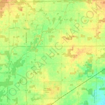
Name: Topografische Karte Madison, Höhe, Relief.
Ort: Madison, Williams County, Ohio, United States (41.61692 -84.57290 41.70387 -84.47587)
Durchschnittliche Höhe: 269 m
Minimale Höhe: 251 m
Maximale Höhe: 282 m
Andere topografische Karten
Klicken Sie auf eine Karte, um ihre Topografie, ihre Höhe und ihr Relief anzuzeigen.
Blakeslee
United States > Ohio > Williams County
Blakeslee, Florence, Williams County, Ohio, 43505, United States
Durchschnittliche Höhe: 263 m
Columbia
United States > Ohio > Williams County > Northwest
Columbia, Northwest, Williams County, Ohio, United States
Durchschnittliche Höhe: 298 m
Northwest
United States > Ohio > Williams County > Northwest
Northwest, Williams County, Ohio, United States
Durchschnittliche Höhe: 294 m