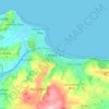
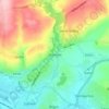
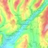
Topografische Karte Penrice
Klicken Sie auf die Karte, um die Höhe anzuzeigen.
Über diese Karte

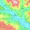
Name: Topografische Karte Penrice, Höhe, Relief.
Ort: Penrice, Swansea, Wales, United Kingdom (51.54010 -4.21596 51.58808 -4.13893)
Durchschnittliche Höhe: 55 m
Minimale Höhe: 0 m
Maximale Höhe: 181 m
Andere topografische Karten
Klicken Sie auf eine Karte, um ihre Topografie, ihre Höhe und ihr Relief anzuzeigen.
Snowdon
United Kingdom > Wales > Gwynedd
Snowdon (/ˈsnoʊdən/) or Yr Wyddfa (pronounced [ər ˈʊɨ̞̯ðva] (listen)), is the highest mountain in Wales, at an elevation of 1,085 metres (3,560 ft) above sea level, and the highest point in the British Isles outside the Scottish Highlands. It is located in Snowdonia National Park (Parc Cenedlaethol…
Durchschnittliche Höhe: 692 m
Brymbo
United Kingdom > Wales > Wrexham
While there was mining of coal in the area on a small scale, the late eighteenth century saw an expansion in activity, particularly after the industrialist John "Iron-Mad" Wilkinson purchased Brymbo Hall and began developing its estate, mining coal and ironstone and building an ironworks which was later to…
Durchschnittliche Höhe: 195 m
National Botanic Garden of Wales
United Kingdom > Wales > Carmarthenshire > Llanarthney
Durchschnittliche Höhe: 90 m


Knighton
United Kingdom > Wales > Powys
The town became a borough in 1203, with a charter permitting a weekly market and annual fair. The presence of two castles within a comparatively small town suggests that one (the earlier motte and bailey sited atop the town) went out of use before the establishment of the second (the motte with no bailey at…
Durchschnittliche Höhe: 295 m
Swansea
United Kingdom > Wales > Swansea
Much of Swansea is hilly with the main area of upland being located in the council ward of Mawr. Areas up to 185 metres (607 ft) in elevation range across the central section: Kilvey Hill, Townhill and Llwynmawr separate the centre of Swansea from its northern suburbs. Cefn Bryn, a ridge of high land, is the…
Durchschnittliche Höhe: 73 m



Cwmystwyth Lead Mine Workings
United Kingdom > Wales > Ceredigion > Pontarfynach
Durchschnittliche Höhe: 403 m








Maerdy Park
United Kingdom > Wales > Merthyr Tydfil County Borough > Merthyr Tydfil
Durchschnittliche Höhe: 223 m




New Castle
United Kingdom > Wales > Monmouthshire > Llangattock Vibon Avel > Newcastle
Durchschnittliche Höhe: 121 m


Aberystwyth
United Kingdom > Wales > Ceredigion
Aberystwyth experiences an oceanic climate (Köppen climate classification Cfb) similar to almost all of the United Kingdom. This is particularly pronounced due to its west coast location facing the Irish Sea. Air undergoes little land moderation and so temperatures closely reflect the sea temperature when…
Durchschnittliche Höhe: 39 m