Geolokalisieren

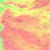
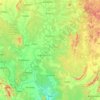
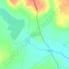
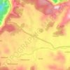
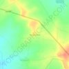
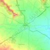
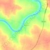
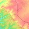
Topografische Karte Shrigonda

Klicken Sie auf die Karte, um die Höhe anzuzeigen.

Über diese Karte

Name: Topografische Karte Shrigonda, Höhe, Relief.

Ort: Shrigonda, Ahmednagar District, Maharashtra, India (18.44969 74.38459 18.90296 74.93772)

Durchschnittliche Höhe: 590 m

Minimale Höhe: 493 m

Maximale Höhe: 839 m

Andere topografische Karten

Klicken Sie auf eine Karte, um ihre Topografie, ihre Höhe und ihr Relief anzuzeigen.
Pune

India > Maharashtra > Pune City Subdistrict

Durchschnittliche Höhe: 641 m

Maharashtra

India > Maharashtra

Maharashtra is the third largest state by area in India. The Western Ghats better known as Sahyadri, are a hilly range running parallel to the coast, at an average elevation of 1,200 metres (4,000 ft). Kalsubai, a peak in the Sahyadris, near Nashik city is the highest elevated point in Maharashtra. To the west…

Durchschnittliche Höhe: 478 m

Sinhagad Fort

India > Maharashtra > Kalyan Gaon

Durchschnittliche Höhe: 995 m

Mumbai

India > Maharashtra

Mumbai lies at the mouth of the Ulhas River on the western coast of India, in the coastal region known as the Konkan. It sits on Salsette Island (Sashti Island), which it partially shares with the Thane district. Mumbai is bounded by the Arabian Sea to the west. Many parts of the city lie just above sea level,…

Durchschnittliche Höhe: 13 m
Ajinkyatara Fort

India > Maharashtra > Satara > Satara

Ajinkyatara Fort, also known as the "Fort of the Sapta-Rishi," is a historical hill fort located on Ajinkyatara Mountain, one of the seven mountains surrounding the city of Satara in the Sahyadri Mountains of Maharashtra, India. Situated at an altitude of 3,300 feet, the fort overlooks Satara City and is…

Durchschnittliche Höhe: 764 m

Magarpatta City School Ground

India > Maharashtra > Pune

Durchschnittliche Höhe: 568 m

Pune

India > Maharashtra > Pune City Subdistrict

Durchschnittliche Höhe: 641 m

Nashik

India > Maharashtra

Durchschnittliche Höhe: 555 m

Jalgaon

India > Maharashtra

Durchschnittliche Höhe: 360 m

Chandrapur

India > Maharashtra

Durchschnittliche Höhe: 243 m

Ghotan

India > Maharashtra > Shevgaon

Durchschnittliche Höhe: 479 m

Vishalgad

India > Maharashtra > Shahuwadi

Durchschnittliche Höhe: 508 m

Shivneri Fort

India > Maharashtra > Junnar > Junnar

Durchschnittliche Höhe: 746 m

Jambulmal

India > Maharashtra

Durchschnittliche Höhe: 256 m

Rasayani

India > Maharashtra > Khalapur Taluka

Durchschnittliche Höhe: 48 m

Ganesh Talav

India > Maharashtra > Haveli > Pimpri-Chinchwad

Durchschnittliche Höhe: 593 m

Siddheshwar Dam

India > Maharashtra > Aundha (Nagnath)

Durchschnittliche Höhe: 416 m

Visapur Fort

India > Maharashtra > Mawal Subdistrict > Patan

Durchschnittliche Höhe: 818 m

Lohgad

India > Maharashtra > Mawal Subdistrict > Dudhivare

Lohagad is one of the many hill forts of Maharashtra state in India. Situated close to the hill station Lonavala and 52 km (32 mi) northwest of Pune, Lohagad rises to an elevation of 1,033 m (3,389 ft) above sea level. The fort is connected to the neighboring Visapur fort by a small range. The fort was under…

Durchschnittliche Höhe: 797 m

Rasalgad Fort

India > Maharashtra > Khed Taluka > Humbari Varchi

Durchschnittliche Höhe: 283 m

Prachitgad

India > Maharashtra > Sangameshwar Taluka

Durchschnittliche Höhe: 588 m

Mhalunge

India > Maharashtra

Durchschnittliche Höhe: 780 m

Amravati

India > Maharashtra > Amravati

Amravati is located at 20°56′N 77°45′E / 20.93°N 77.75°E / 20.93; 77.75. It has an average elevation of 343 meters (1125 feet). It lies 156 km (97 mi) west of Nagpur and serves as the administrative centre of Amravati District and of Amravati Division. The city is located near the passes…

Durchschnittliche Höhe: 345 m

Ahmadnagar

India > Maharashtra

Durchschnittliche Höhe: 596 m

Girna River

India > Maharashtra

Durchschnittliche Höhe: 368 m

Koyna River

India > Maharashtra

Durchschnittliche Höhe: 346 m

Panvel

India > Maharashtra > Panvel > Panvel

Matheran is a hill station and a municipal council in the Raigad district in the Indian state of Maharashtra. It is a hill station in Karjat Tahsil and is also the smallest hill station in India. It is located on the Western Ghats range at an elevation of around 800 m (2,625 feet) above sea level. It is…

Durchschnittliche Höhe: 75 m
Kolhapur

India > Maharashtra > Karvir

Kolhapur is an inland city located in south-west Maharashtra state, 373 km (232 mi) south of Mumbai and 228 km (142 mi) south of Pune, 615 km (382 mi) north-west of Bengaluru and 530 km (330 mi) west of Hyderabad. Within Maharashtra, Kolhapur's nearest cities and towns are Ichalkaranji 27 km (17 mi), Kodoli 35…

Durchschnittliche Höhe: 592 m
Dharavi

India > Maharashtra

Durchschnittliche Höhe: 6 m

Bhatsa

India > Maharashtra

Durchschnittliche Höhe: 130 m

Yelgaon Dam

India > Maharashtra

Durchschnittliche Höhe: 611 m

Kale

India > Maharashtra

Durchschnittliche Höhe: 588 m

Degma Bk

India > Maharashtra

Durchschnittliche Höhe: 385 m

Asoli

India > Maharashtra

Durchschnittliche Höhe: 295 m

Lohagad Fort

India > Maharashtra > Mawal > Malavli > Lohagadwadi

Durchschnittliche Höhe: 796 m

Gorai

India > Maharashtra

Durchschnittliche Höhe: 5 m

Ambajogai

India > Maharashtra > Ambejogai

Durchschnittliche Höhe: 633 m

Amba

India > Maharashtra > Shahuwadi

Durchschnittliche Höhe: 619 m

Mumbai

India > Maharashtra

The majority of the city lies just above the mean sea level, with elevations ranging from 10 to 15 m (33 to 49 ft), and an average elevation of 14 m (46 ft). Northern Mumbai consists of hilly terrain, with the highest point in the city at 450 m (1,480 ft) in the Powai–Kanheri range. The coastline is indented…

Durchschnittliche Höhe: 13 m
Navi Mumbai

India > Maharashtra > Thane > Navi Mumbai

Navi Mumbai (Marathi pronunciation: , also known by its former name New Bombay), is a planned city off the west coast of the Indian state of Maharashtra in Konkan division. The city is divided into two parts, North Navi Mumbai and South Navi Mumbai, for the individual development of Panvel Mega City, which…

Durchschnittliche Höhe: 30 m
Naigaon

India > Maharashtra > Kaij

Durchschnittliche Höhe: 640 m

Khopoli

India > Maharashtra > Khalapur Taluka

Durchschnittliche Höhe: 223 m

Khandala

India > Maharashtra > Khandala

Adjacent to the Lohagad fort lies the visapur fort which is part of the Lohagad-Visapur fortification. Visapur Fort is larger and at a higher elevation than its twin- Lohagad. It was built during 1713-1720 CE by Balaji Vishwanath.

Durchschnittliche Höhe: 662 m
Wai

India > Maharashtra > Wai

Wai is located at 17°56′N 73°53′E / 17.94°N 73.88°E / 17.94; 73.88, approximately 35 km (22 mi) north of the city of Satara. It has an average elevation of 718 metres (2,356 ft). It is surrounded by the mountainous region of the Sahyādris.

Durchschnittliche Höhe: 762 m
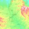
Ahilyanagar

India > Maharashtra > Ahmednagar

Durchschnittliche Höhe: 692 m

Vaibhavwadi

India > Maharashtra > Vaibhavwadi

Durchschnittliche Höhe: 82 m

Morbe Dam

India > Maharashtra > Khalapur Taluka > Chowk

Durchschnittliche Höhe: 61 m

Raireshwar Fort

India > Maharashtra > Bhor

Durchschnittliche Höhe: 1.145 m

Salekasa

India > Maharashtra > Salekasa Taluka > Salekasa

Durchschnittliche Höhe: 325 m

Chintal Dhaba

India > Maharashtra > Gondpipri

Durchschnittliche Höhe: 185 m

Devagiri Fort

India > Maharashtra > Chhatrapati Sambhajinagar > Daulatabad

Durchschnittliche Höhe: 606 m

Tung Fort

India > Maharashtra > Mawal

Durchschnittliche Höhe: 733 m

Tikona Fort

India > Maharashtra > Mawal > Tikona Peth

Durchschnittliche Höhe: 742 m

Natepute

India > Maharashtra > Malshiras

Durchschnittliche Höhe: 535 m

Purandar Fort

India > Maharashtra > Purandhar > Narayanpur

Durchschnittliche Höhe: 1.027 m

Rangana Fort

India > Maharashtra > Kudal Taluka > Gothos

Durchschnittliche Höhe: 462 m

Uran

India > Maharashtra > Uran Subdistrict

Uran is located at 18°53′N 72°56′E / 18.88°N 72.94°E / 18.88; 72.94. Uran is at an average elevation of 21 metres (69 ft).

Durchschnittliche Höhe: 10 m

Tambha

India > Maharashtra > Deoli

Durchschnittliche Höhe: 252 m

Borgaon Manju

India > Maharashtra > Akola

Durchschnittliche Höhe: 295 m

Shahada

India > Maharashtra > Shahada Taluka

Durchschnittliche Höhe: 140 m

Narhe

India > Maharashtra > Bhor

Durchschnittliche Höhe: 683 m

Ratangad

India > Maharashtra > Akola > Ratanwadi

Durchschnittliche Höhe: 872 m

Bhidi

India > Maharashtra > Deoli

Durchschnittliche Höhe: 254 m

Miraj

India > Maharashtra > Miraj

Durchschnittliche Höhe: 555 m

Nandgao Tanda

India > Maharashtra > Ambejogai

Durchschnittliche Höhe: 648 m

Bhawan

India > Maharashtra > Sillod

Durchschnittliche Höhe: 596 m

Bhudargad

India > Maharashtra > Gargoti > Thanewadi

Durchschnittliche Höhe: 841 m

Ane

India > Maharashtra > Junnar

Durchschnittliche Höhe: 824 m

Moula Ali

India > Maharashtra > Mukhed > Manjari

Durchschnittliche Höhe: 453 m

Malegaon Budruk

India > Maharashtra > Georai

Durchschnittliche Höhe: 448 m

Selgaon (umate)

India > Maharashtra > Karanja

Durchschnittliche Höhe: 484 m

Rajapur

India > Maharashtra > Rajapur Taluka

Durchschnittliche Höhe: 134 m

Dhalewadi

India > Maharashtra > Patoda

Durchschnittliche Höhe: 744 m

Sasura

India > Maharashtra > Kaij

Durchschnittliche Höhe: 729 m

Shirgaon

India > Maharashtra > Tasgaon

Durchschnittliche Höhe: 594 m

Parbhani

India > Maharashtra > Parbhani

Parbhani is located at 19°16′N 76°47′E / 19.27°N 76.78°E / 19.27; 76.78. It has an average elevation of 347 metres.

Durchschnittliche Höhe: 411 m
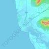
Alibag

India > Maharashtra > Alibag Taluka

Alibag is located about 120 km south of Mumbai, at 18°38′29″N 72°52′20″E / 18.64139°N 72.87222°E / 18.64139; 72.87222. The average elevation is 0 metres (0 feet).The District Government offices are located along the sea coast road. Alibag is the center place of Raigad District.

Durchschnittliche Höhe: 12 m
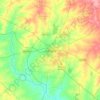
Solapur

India > Maharashtra > Solapur North

Solapur is located at 17°41′N 75°55′E / 17.68°N 75.92°E / 17.68; 75.92. It has an average elevation of 458 metres (1502 feet). It is bordered by Ahmednagar district on the north; Osmanabad district on the north and northeast.

Durchschnittliche Höhe: 469 m
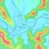
Mahad

India > Maharashtra > Mahad Taluka

Several disasters like floods and landslides have continuously devastated markets and old houses, specifically classic Konkani-styled architecture, causing great loss of life. This is primarily due to lower elevation of the city compared to surrounding areas and being surrounded by rivers on all sides, making…

Durchschnittliche Höhe: 75 m

Pandharpur

India > Maharashtra > Pandharpur

Durchschnittliche Höhe: 459 m

Ramtek

India > Maharashtra > Ramtek

Durchschnittliche Höhe: 322 m

Saswad

India > Maharashtra > Purandhar

Durchschnittliche Höhe: 787 m

Patnus

India > Maharashtra > Mangaon

Durchschnittliche Höhe: 132 m

korlai

India > Maharashtra > Murud Taluka > Korlai

Durchschnittliche Höhe: 2 m

Waifad

India > Maharashtra > Wardha

Durchschnittliche Höhe: 281 m

Ghatghar

India > Maharashtra > Junnar

Durchschnittliche Höhe: 757 m

Bhimashankar

India > Maharashtra > Khed

Durchschnittliche Höhe: 749 m

Ganeshgaon

India > Maharashtra > Malshiras

Durchschnittliche Höhe: 483 m

Naigaon Mayur WLS

India > Maharashtra > Patoda > Naigaon

Durchschnittliche Höhe: 680 m

Naigaon

India > Maharashtra > Patoda

Durchschnittliche Höhe: 662 m

Patoda Belkhandi

India > Maharashtra > Beed

Durchschnittliche Höhe: 678 m

Kudali

India > Maharashtra > Roha

Durchschnittliche Höhe: 124 m

Achra

India > Maharashtra > Malvan Taluka

Durchschnittliche Höhe: 22 m

Ujani

India > Maharashtra > Ausa

Durchschnittliche Höhe: 616 m

Yelavi

India > Maharashtra > Jat

Durchschnittliche Höhe: 583 m

Joggers Park

India > Maharashtra > Mumbai

Durchschnittliche Höhe: 6 m

Moshi Traffic Park

India > Maharashtra > Haveli > Pimpri-Chinchwad

Durchschnittliche Höhe: 603 m

Mulshi

India > Maharashtra > Mulshi

Durchschnittliche Höhe: 744 m

Wadgaon J.

India > Maharashtra > Kalamb

Durchschnittliche Höhe: 674 m

Rüsten Sie sich für Ihr nächstes Abenteuer:

🦯Carbon-Trekkingstöcke - Ultraleichte Stöcke zur Entlastung der Knie beim Abstieg
🔥Sturmhölzer - Zünden auch bei starkem Wind und Nässe
🧯Feuerstarter Set - Zuverlässiger Feuerstarter für Camping
🧦Merino-Wandersocken - Blasenfreie Wanderungen durch beste Materialeigenschaften
🛁Mikrofaser-Handtücher - Extrem leicht und schnelltrocknend für Trekkingtouren

Als Amazon-Partner erhält diese Website eine Provision für qualifizierte Käufe, ohne zusätzliche Kosten für Sie.