Geolokalisieren

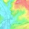
Topografische Karte Stanley

Klicken Sie auf die Karte, um die Höhe anzuzeigen.

Stanley

The Church gates commemorate Queen Victoria's Golden Jubilee of 1887, and the churchyard contains a memorial (erected in 2004) to the five aircrew who lost their lives when an experimental high-altitude RAF Wellington Bomber disintegrated above Stanley in 1942 following a loss of cabin pressure.

Wikipedia (CC-BY-SA 3.0)

Über diese Karte

Name: Topografische Karte Stanley, Höhe, Relief.

Ort: Stanley, Erewash, Derbyshire, East Midlands, England, DE7 6FB, United Kingdom (52.93917 -1.39875 52.97917 -1.35875)

Durchschnittliche Höhe: 100 m

Minimale Höhe: 59 m

Maximale Höhe: 142 m

Andere topografische Karten

Klicken Sie auf eine Karte, um ihre Topografie, ihre Höhe und ihr Relief anzuzeigen.

Long Eaton

United Kingdom > England > Derbyshire > Erewash

Durchschnittliche Höhe: 35 m

Little Eaton

United Kingdom > England > Derbyshire > Erewash

Durchschnittliche Höhe: 82 m

Sandiacre

United Kingdom > England > Derbyshire > Erewash

Durchschnittliche Höhe: 57 m

Breaston

United Kingdom > England > Derbyshire > Erewash

Durchschnittliche Höhe: 40 m

Risley

United Kingdom > England > Derbyshire > Erewash

Durchschnittliche Höhe: 79 m

Derby Canal

United Kingdom > England > Derbyshire > Erewash > Draycott

Durchschnittliche Höhe: 48 m

Stanton by Dale

United Kingdom > England > Derbyshire > Erewash

Durchschnittliche Höhe: 71 m

Morley

United Kingdom > England > Derbyshire > Erewash

Durchschnittliche Höhe: 105 m

Long Eaton

United Kingdom > England > Derbyshire > Erewash

Durchschnittliche Höhe: 31 m

Dale Abbey

United Kingdom > England > Derbyshire > Erewash

Durchschnittliche Höhe: 89 m

Sawley

United Kingdom > England > Derbyshire > Erewash

Durchschnittliche Höhe: 32 m

Ilkeston

United Kingdom > England > Derbyshire > Erewash

Durchschnittliche Höhe: 72 m

Breadsall

United Kingdom > England > Derbyshire > Erewash

Durchschnittliche Höhe: 87 m

River Erewash

United Kingdom > England > Derbyshire > Erewash

The approximate meaning of the name is not in doubt, but there is room for debate about the precise derivation and its connotations. Brewer gives the commonly accepted explanation that it comes from the Old English words irre ("wandering") and wisce ("wet meadow"). This is accepted by Kenneth Cameron, a…

Durchschnittliche Höhe: 87 m

Ilkeston

United Kingdom > England > Derbyshire > Erewash

Durchschnittliche Höhe: 72 m

Sawley

United Kingdom > England > Derbyshire > Erewash

Durchschnittliche Höhe: 32 m

Long Eaton

United Kingdom > England > Derbyshire > Erewash

Durchschnittliche Höhe: 35 m

Long Eaton

United Kingdom > England > Derbyshire > Erewash

Durchschnittliche Höhe: 35 m

Ilkeston

United Kingdom > England > Derbyshire > Erewash

Durchschnittliche Höhe: 72 m

Rüsten Sie sich für Ihr nächstes Abenteuer:

🥾Trekkingsandalen - Luftige Sandalen für leichte Wanderwege
📷Kamera-Rucksackhalterungen - Sicherer Zugriff auf die Kamera beim Wandern
🗺️Topografische Wanderkarten - Gedruckte Regionalkarten für Deutschland im Maßstab 1:25.000
📖Bücher: Orientierung im Gelände - Fachliteratur zu Navigation, Kompasskunde und GPS-Nutzung
🔐Zelt Schloss Sicherheit - Schützt Ausrüstung beim Campen

Als Amazon-Partner erhält diese Website eine Provision für qualifizierte Käufe, ohne zusätzliche Kosten für Sie.