Geolokalisieren

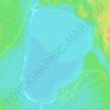
Topografische Karte Montreal Lake

Klicken Sie auf die Karte, um die Höhe anzuzeigen.

Über diese Karte

Name: Topografische Karte Montreal Lake, Höhe, Relief.

Ort: Montreal Lake, Unorganized Division No. 18, Saskatchewan, Canada (54.04725 -105.85050 54.62875 -105.53800)

Durchschnittliche Höhe: 536 m

Minimale Höhe: 470 m

Maximale Höhe: 682 m

Andere topografische Karten

Klicken Sie auf eine Karte, um ihre Topografie, ihre Höhe und ihr Relief anzuzeigen.

Suggi Lake

Canada > Saskatchewan > Unorganized Division No. 18

Durchschnittliche Höhe: 295 m

Big Island

Canada > Saskatchewan > Unorganized Division No. 18

Durchschnittliche Höhe: 469 m

English Bay

Canada > Saskatchewan > Unorganized Division No. 18

Durchschnittliche Höhe: 376 m

Zeden Lake

Canada > Saskatchewan > Unorganized Division No. 18

Durchschnittliche Höhe: 526 m

Primrose Lake

Canada > Saskatchewan > Unorganized Division No. 18

Primrose Lake has a total surface area of 444 km2 (171 sq mi), 17.7 km2 (6.8 sq mi) of which is in Alberta, and an elevation of 559 metres (1,834 ft). It lies within muskeg and the boreal forest ecozone of Canada. There are several rivers and creeks that flow into the lake with Calder River on the northern…

Durchschnittliche Höhe: 607 m
Eldorado

Canada > Saskatchewan > Unorganized Division No. 18

Durchschnittliche Höhe: 283 m

Potato Lake

Canada > Saskatchewan > Unorganized Division No. 18

Durchschnittliche Höhe: 377 m

Rüsten Sie sich für Ihr nächstes Abenteuer:

🔭Ferngläser 8x42 - Der Allrounder für Natur- und Geländebeobachtung
🌞Solar Zeltbeleuchtung - Umweltfreundliche Lichtquelle fürs Camp
🪶Leichtgewicht Regenponcho - Kompakter Wetterschutz für Wanderungen
📡Satelliten Notrufgerät - Sicherheitsgerät mit SOS‑Funktion weltweit
📍GPS Gerät für Wandern - Handliches GPS‑Navigationsgerät mit Outdoor‑Funktionen

Als Amazon-Partner erhält diese Website eine Provision für qualifizierte Käufe, ohne zusätzliche Kosten für Sie.