

Topografische Karten Saskatchewan
Klicken Sie auf eine Karte, um ihre Topografie, ihre Höhe und ihr Relief anzuzeigen.













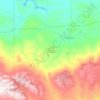
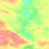
Buffalo Pound Provincial Park
Canada > Saskatchewan > Marquis No. 191
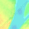
Nicolle Flats Marsh, with a total area of 73.18 km2 (28.25 sq mi) and an elevation of 511 m (1,677 ft), is a large marshy area located in the park at the south-east corner of Buffalo Pound Lake. The confluence of the Qu'Appelle and Moose Jaw Rivers is in the marsh. The area is an Important Bird Area of Canada…
Durchschnittliche Höhe: 572 m










Prince Albert National Park
About 90% of the park is in the Waskesiu Hills and elevations range from 488 m (1,601 ft) on the western side to 724 m (2,375 ft) on the eastern side. There are several large lakes in the park, including Waskesiu, Kingsmere, and Crean, and several notable rivers have their source there, such as Spruce,…
Durchschnittliche Höhe: 557 m


