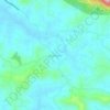
Topografische Karte Chandigarh
Klicken Sie auf die Karte, um die Höhe anzuzeigen.
Chandigarh
Chandigarh is located by the foothills of the Shivalik Range of the Himalayas in northwest India. It covers an area of approximately 114 km2. It borders the states of Punjab and Haryana. The exact geographic coordinates of Chandigarh are 30°44′N 76°47′E / 30.74°N 76.79°E / 30.74; 76.79. It has an average elevation of 321 metres (1053 ft).
Über diese Karte

Name: Topografische Karte Chandigarh, Höhe, Relief.
Ort: Chandigarh, India (30.66497 76.70499 30.79495 76.84903)
Durchschnittliche Höhe: 343 m
Minimale Höhe: 300 m
Maximale Höhe: 511 m
Andere topografische Karten
Klicken Sie auf eine Karte, um ihre Topografie, ihre Höhe und ihr Relief anzuzeigen.
Maharashtra
Maharashtra is the third largest state by area in India. The Western Ghats better known as Sahyadri, are a hilly range running parallel to the coast, at an average elevation of 1,200 metres (4,000 ft). Kalsubai, a peak in the Sahyadris, near Nashik city is the highest elevated point in Maharashtra. To the west…
Durchschnittliche Höhe: 478 m
Bhubaneshwar
India > Odisha > Bhubaneswar (M.Corp.)
Bhubaneswar is in Khordha district of Odisha. It is in the eastern coastal plains, along the axis of the Eastern Ghats mountains. The city has an average altitude of 45 m (148 ft) above sea level. It lies southwest of the Mahanadi River that forms the northern boundary of Bhubaneswar metropolitan area, within…
Durchschnittliche Höhe: 30 m
Nagarjun Sagar Right Canal
India > Andhra Pradesh > Macherla > Javuk Thanda
Durchschnittliche Höhe: 180 m
Shimla
Shimla is on the south-western ranges of the Himalayas at 31°37′N 77°06′E / 31.61°N 77.10°E / 31.61; 77.10. It has an average altitude of 2,206 metres (7,238 ft) above mean sea level and extends along a ridge with seven spurs. The city stretches nearly 9.2 kilometres (5.7 mi) from east to west.
Durchschnittliche Höhe: 1.557 m
Lucknow
India > Uttar Pradesh > Lucknow
Lucknow stands at an elevation of approximately 123 metres (404 ft) above sea level. The city had an area of 402 km2 (155 square miles) until December 2019, when 88 villages were added to the municipal limits and the area increased to 631 km2 (244 square miles). Bounded on the east by Barabanki, on the west by…
Durchschnittliche Höhe: 120 m
Erattupetta
It has an average elevation of 36 metres (118 feet).
Durchschnittliche Höhe: 78 m

Mumbai
Mumbai lies at the mouth of the Ulhas River on the western coast of India, in the coastal region known as the Konkan. It sits on Salsette Island (Sashti Island), which it partially shares with the Thane district. Mumbai is bounded by the Arabian Sea to the west. Many parts of the city lie just above sea level,…
Durchschnittliche Höhe: 13 m

Shimla
Shimla is on the south-western ranges of the Himalayas at 31°37′N 77°06′E / 31.61°N 77.10°E / 31.61; 77.10. It has an average altitude of 2,206 metres (7,238 ft) above mean sea level and extends along a ridge with seven spurs. The city stretches nearly 9.2 kilometres (5.7 mi) from east to west.
Durchschnittliche Höhe: 1.557 m
Navi Mumbai
India > Maharashtra > Thane > Navi Mumbai
Navi Mumbai (Marathi pronunciation: , also known by its former name New Bombay), is a planned city off the west coast of the Indian state of Maharashtra in Konkan division. The city is divided into two parts, North Navi Mumbai and South Navi Mumbai, for the individual development of Panvel Mega City, which…
Durchschnittliche Höhe: 30 m
Guwahati
Professor Abani Kumar Bhagawati of Gauhati University stated that since before there were sufficient wetlands to absorb rainwater and channels to carry excess water to the Brahmaputra, the city did not experience floods. However, human interference has disrupted the natural topography, leading to the current…
Durchschnittliche Höhe: 113 m










Jabalpur
India > Madhya Pradesh > Ranjhi Tahsil
The Narmada river bringing in freshwater from the Vindyachal Ranges has developed Jabalpur district into an agrarian economy. The land of the Narmada basin with its fertile alluvial soil gives good yields of sorghum, wheat, rice, and millet in the villages around Jabalpur. Important among commercial crops are…
Durchschnittliche Höhe: 408 m

Dakshina Kannada
The topography of the district is plain up to 30 km (18.64 mi) inside the coast and changes to undulating hilly terrain sharply towards the east in the Western Ghats. Teak, bamboo and rosewood trees are found in the hilly areas towards the east. The Geological Survey of India has identified this district as a…
Durchschnittliche Höhe: 109 m


Mysuru
India > Karnataka > Mysuru taluk
Mysore (/maɪˈsɔːr/ (listen)), officially Mysuru ([ˈmaɪˈsuːɾu] (listen)), is a city in the southern part of the state of Karnataka, India. Mysore city is geographically located between 12° 18′ 26″ north latitude and 76° 38′ 59″ east longitude. It is located at an altitude of 770 m (2,530 ft)…
Durchschnittliche Höhe: 727 m

Ranchi
Ranchi lies at 23°22′N 85°20′E / 23.36°N 85.33°E / 23.36; 85.33 near to the Tropic of Cancer. The city covers an area of 175 km2 (68 sq mi) and its average elevation is 651 m above sea level. Ranchi is located in the southern part of the Chota Nagpur plateau, which is the eastern section of…
Durchschnittliche Höhe: 648 m


Sonamukhi
India > West Bengal > Sonamukhi
Sonamukhi is located at 23°18′N 87°25′E / 23.3°N 87.42°E / 23.3; 87.42. It has an average elevation of 66 m (217 ft).
Durchschnittliche Höhe: 62 m


Mashobra
India > Himachal Pradesh > Shimla (urban)
Mashobra is located at 31°08′N 77°14′E / 31.13°N 77.23°E / 31.13; 77.23. It has an average elevation of 2,146 metres (7,041 feet).
Durchschnittliche Höhe: 1.938 m
Dhrangadhra
India > Gujarat > Dhrangadhra Taluka
Dhrangadhra is located at 22°59′N 71°28′E / 22.98°N 71.47°E / 22.98; 71.47. It has an average elevation of 64 metres (209 feet).
Durchschnittliche Höhe: 52 m





Chamorshi
India > Maharashtra > Chamorshi Taluka
Charmoshi has an average elevation of 182 metres (600 feet).
Durchschnittliche Höhe: 194 m


Padampur
Padmapur is located at 21°00′N 83°04′E / 21.0°N 83.07°E / 21.0; 83.07. It has an average elevation of 205 metres (673 ft). It is almost 75 kilometres (47 mi) from its district headquarters, Bargarh. It is about 440 kilometres (270 mi) from its capital city of Bhubaneshwar.
Durchschnittliche Höhe: 195 m



Wai
India > Maharashtra > Wai
Wai is located at 17°56′N 73°53′E / 17.94°N 73.88°E / 17.94; 73.88, approximately 35 km (22 mi) north of the city of Satara. It has an average elevation of 718 metres (2,356 ft). It is surrounded by the mountainous region of the Sahyādris.
Durchschnittliche Höhe: 762 m

Western Ghats
The range starts near south of the Tapti river and runs approximately 1,600 km (990 mi) through the states of Gujarat, Maharashtra, Karnataka, Goa, Kerala and Tamil Nadu ending at Marunthuvazh Malai, Swamithope near the southern tip of India. These hills cover 160,000 km2 (62,000 sq mi) and form the catchment…
Durchschnittliche Höhe: 2.225 m

Amravati
India > Maharashtra > Amravati
Amravati is located at 20°56′N 77°45′E / 20.93°N 77.75°E / 20.93; 77.75. It has an average elevation of 343 meters (1125 feet). It lies 156 km (97 mi) west of Nagpur and serves as the administrative centre of Amravati District and of Amravati Division. The city is located near the passes…
Durchschnittliche Höhe: 345 m

Sirsi
India > Karnataka > Shirasi taluk
Sirsi is located at 14°37′N 74°51′E / 14.62°N 74.85°E / 14.62; 74.85 (Grid Square MK74).[3] It has an elevation ranging between 1860 feet to 2600 feet above sea level, and is situated in the heart of the Western Ghats. Sirsi is about 399 kilometres (248 mi) from Bangalore. The nearest airport…
Durchschnittliche Höhe: 580 m
Lonavala
India > Maharashtra > Mawal
Adjacent to the Lohagad fort lies the visapur fort which is part of the Lohagad-Visapur fortification. Visapur Fort is larger and at a higher elevation than its twin- Lohagad. It was built during 1713-1720 CE by Balaji Vishwanath.
Durchschnittliche Höhe: 613 m
Mussoorie
India > Uttarakhand > Dehradun
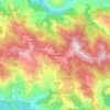
Mussoorie is at an average altitude of 2,005 metres (6,578 ft). To the northeast are the Himalayan snow ranges, and to the south, the Doon Valley and Shiwalik ranges. The second highest point is the original Lal Tibba in Landour, with a height of over 2,275 m (7,464 ft). Mussoorie is popularly known as The…
Durchschnittliche Höhe: 1.594 m
Thiruvananthapuram
India > Kerala > Thiruvananthapuram
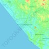
Thiruvananthapuram is built on seven hills by the seashore and is at 8°30′N 76°54′E / 8.5°N 76.9°E / 8.5; 76.9 on the west coast, near the southern tip of mainland India. The city is on the west coast of India and is bounded by the Laccadive Sea to its west and the Western Ghats to its east.…
Durchschnittliche Höhe: 33 m
Kanchipuram
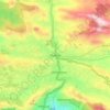
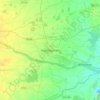
Kanchipuram is located at 12°50′19″N 79°42′06″E / 12.8387°N 79.7016°E / 12.8387; 79.7016, 72 km (45 mi) south-west of Chennai on the banks of the Vegavathi River, a tributary of the Palar River. The city covers an area of 11.6 km2 (4.5 sq mi) and has an elevation of 83.2 m (273 ft) above…
Durchschnittliche Höhe: 82 m

Bhubaneshwar
India > Odisha > Bhubaneswar (M.Corp.)
Bhubaneswar is in Khordha district of Odisha. It is in the eastern coastal plains, along the axis of the Eastern Ghats mountains. The city has an average altitude of 45 m (148 ft) above sea level. It lies southwest of the Mahanadi River that forms the northern boundary of Bhubaneswar metropolitan area, within…
Durchschnittliche Höhe: 30 m
Thanjavur
India > Tamil Nadu > Thanjavur
Thanjavur is located at 10°48′N 79°09′E / 10.8°N 79.15°E / 10.8; 79.15 The tributaries of river Cauvery, namely, the Grand Anaicut canal (Pudhaaru), Vadavaaru and Vennaaru rivers flow through the city. Thanjavur is situated in the Cauvery delta, at a distance of 314 km (195 mi) south-west of…
Durchschnittliche Höhe: 49 m