
Topografische Karte Grande Prairie
Interaktive Karte
Klicken Sie auf die Karte, um die Höhe anzuzeigen.
Über diese Karte
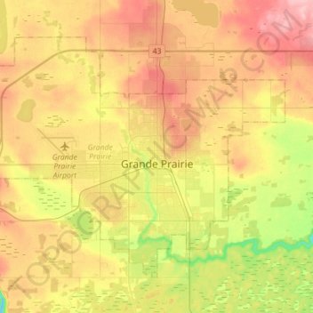
Name: Topografische Karte Grande Prairie, Höhe, Relief.
Ort: Grande Prairie, Division No. 19, Alberta, Canada (55.11247 -118.96176 55.23618 -118.67955)
Durchschnittliche Höhe: 665 m
Minimale Höhe: 600 m
Maximale Höhe: 726 m
Grande Prairie is located just north of the 55th parallel north, and is 465 km (289 mi) northwest of Edmonton, lying at an elevation of 669 m (2,195 ft) above sea level. The city is surrounded by farmland to the north, east, and west. To the south lies a vast boreal forest with aspen, tamarack, lodgepole pine, jack pine, and black spruce extending well into the foothills of the Canadian Rockies south and southwest of the city.
Andere topografische Karten
Klicken Sie auf eine Karte, um ihre Topografie, ihre Höhe und ihr Relief anzuzeigen.
Clairmont
Canada > Alberta > Division No. 19 > Hamlet of Clairmont
Clairmont, Hamlet of Clairmont, Division No. 19, Alberta, T0H 0W0, Canada
Durchschnittliche Höhe: 679 m
Village of Donnelly
Canada > Alberta > Division No. 19
Village of Donnelly, Division No. 19, Alberta, Canada
Durchschnittliche Höhe: 594 m
La Glace
Canada > Alberta > Division No. 19
La Glace, Division No. 19, Alberta, T0H 2J0, Canada
Durchschnittliche Höhe: 738 m
Beaverlodge
Canada > Alberta > Division No. 19
Beaverlodge, Division No. 19, Alberta, T0H 0C0, Canada
Durchschnittliche Höhe: 735 m