Geolokalisieren

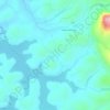
Topografische Karte Muthanga

Klicken Sie auf die Karte, um die Höhe anzuzeigen.

Über diese Karte

Name: Topografische Karte Muthanga, Höhe, Relief.

Ort: Muthanga, Sulthanbathery, Wayanad, Kerala, India (11.65145 76.34191 11.69145 76.38191)

Durchschnittliche Höhe: 866 m

Minimale Höhe: 841 m

Maximale Höhe: 910 m

Andere topografische Karten

Klicken Sie auf eine Karte, um ihre Topografie, ihre Höhe und ihr Relief anzuzeigen.
Kuruva Island

India > Kerala > Sulthanbathery

Durchschnittliche Höhe: 733 m

Kenichira

India > Kerala > Sulthanbathery

Durchschnittliche Höhe: 788 m

Sulthan Bathery

India > Kerala > Sulthanbathery > Sultan Bathery

Durchschnittliche Höhe: 873 m

Marakavu

India > Kerala > Sulthanbathery > Pulpally

Durchschnittliche Höhe: 769 m

Nellarachal

India > Kerala > Sulthanbathery

Durchschnittliche Höhe: 781 m

Vadakkanad

India > Kerala > Sulthanbathery

Durchschnittliche Höhe: 896 m

Edakkal

India > Kerala > Sulthanbathery > Ambalavayal

Durchschnittliche Höhe: 927 m

Kalluvayal

India > Kerala > Sulthanbathery > Pulpally

Durchschnittliche Höhe: 816 m

Seethamount

India > Kerala > Sulthanbathery > Kabanigiri

Durchschnittliche Höhe: 731 m

Kalluvayal

India > Kerala > Sulthanbathery > Pulpally

Durchschnittliche Höhe: 816 m

Poothadi

India > Kerala > Sulthanbathery

Durchschnittliche Höhe: 742 m

Sulthan Bathery

India > Kerala > Sulthanbathery > Sultan Bathery

Durchschnittliche Höhe: 873 m

Rüsten Sie sich für Ihr nächstes Abenteuer:

👕Funktionsshirt fürs Wandern - Atmungsaktives Shirt für Outdoor
🏔️Grödel & Leichtsteigeisen - Sicherer Halt auf vereisten Wegen und Schneefeldern
🛌Isomatten - Komfortable Schlafunterlagen für harte Böden
💡Solar Ladegerät für Handy - Outdoor‑Solarpanel für Energie unterwegs
🔥Ultraleichter Campingkocher - Kompaktes Kochsystem für Rucksacktouren

Als Amazon-Partner erhält diese Website eine Provision für qualifizierte Käufe, ohne zusätzliche Kosten für Sie.