
Topografische Karte Northfield
Interaktive Karte
Klicken Sie auf die Karte, um die Höhe anzuzeigen.
Über diese Karte
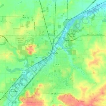
Name: Topografische Karte Northfield, Höhe, Relief.
Durchschnittliche Höhe: 300 m
Minimale Höhe: 269 m
Maximale Höhe: 352 m
Andere topografische Karten
Klicken Sie auf eine Karte, um ihre Topografie, ihre Höhe und ihr Relief anzuzeigen.
Dundas
United States > Minnesota > Rice County
Dundas, Rice County, Minnesota, United States
Durchschnittliche Höhe: 297 m
Heath Creek
United States > Minnesota > Rice County > Northfield
Heath Creek, Northfield, Rice County, Minnesota, 55057, United States
Durchschnittliche Höhe: 292 m
Northfield
United States > Minnesota > Rice County
Northfield, Rice County, Minnesota, 55057, United States
Durchschnittliche Höhe: 300 m