Geolokalisieren

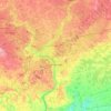
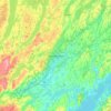
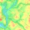
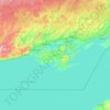
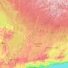
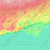
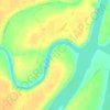
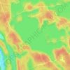
Topografische Karte Durham Region

Klicken Sie auf die Karte, um die Höhe anzuzeigen.

Über diese Karte

Name: Topografische Karte Durham Region, Höhe, Relief.

Ort: Durham Region, Ontario, Canada (43.79307 -79.32799 44.51672 -78.43195)

Durchschnittliche Höhe: 235 m

Minimale Höhe: 72 m

Maximale Höhe: 403 m

Andere topografische Karten

Klicken Sie auf eine Karte, um ihre Topografie, ihre Höhe und ihr Relief anzuzeigen.
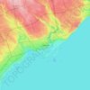
Toronto

Canada > Ontario > Toronto

Despite its deep ravines, Toronto is not remarkably hilly, but its elevation does increase steadily away from the lake. Elevation differences range from 76.5 metres (251 ft) above sea level at the Lake Ontario shore to 209 m (686 ft) ASL near the York University grounds in the city's north end at the…

Durchschnittliche Höhe: 113 m
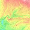
London

Canada > Ontario > London > London

London has a humid continental climate (Köppen Dfb), though due to its downwind location relative to Lake Huron and elevation changes across the city, it is virtually on the Dfa/Dfb (hot summer) boundary favouring the former climate zone to the southwest of the confluence of the South and North Thames Rivers,…

Durchschnittliche Höhe: 268 m
Guelph

Canada > Ontario > Guelph

This region of Ontario has cold winters and warm, humid summers, falling into the Köppen climate classification Dfb zone, with moderately high rainfall and snowfall. It is generally a couple of degrees cooler than lower elevation regions on the Great Lakes shorelines, especially so in winter, the exception…

Durchschnittliche Höhe: 344 m
Hamilton

Canada > Ontario > Hamilton

Durchschnittliche Höhe: 181 m

Parry Sound

Canada > Ontario

Durchschnittliche Höhe: 235 m

Belleville

Canada > Ontario > Belleville

Durchschnittliche Höhe: 107 m

Haliburton

Canada > Ontario

Durchschnittliche Höhe: 358 m

Kingston

Canada > Ontario > Kingston

Durchschnittliche Höhe: 94 m

Cambridge

Canada > Ontario > Cambridge

Durchschnittliche Höhe: 295 m

Niagara Escarpment

Canada > Ontario

Durchschnittliche Höhe: 299 m

Windsor

Canada > Ontario > Windsor

Durchschnittliche Höhe: 185 m

Trenton

Canada > Ontario > Quinte West

Durchschnittliche Höhe: 89 m

Brantford

Canada > Ontario > Brantford

Durchschnittliche Höhe: 238 m

Christie Pits Park

Canada > Ontario > Old Toronto

Durchschnittliche Höhe: 117 m

Gooderham

Canada > Ontario > Haliburton County > Highlands East

Durchschnittliche Höhe: 349 m

Smiths Falls

Canada > Ontario > Smiths Falls

Durchschnittliche Höhe: 125 m

Bowmanville

Canada > Ontario > Bowmanville

Durchschnittliche Höhe: 108 m

Gloucester Pool

Canada > Ontario > Georgian Bay Township

Durchschnittliche Höhe: 186 m

Ompah

Canada > Ontario > Frontenac County > North Frontenac

Durchschnittliche Höhe: 298 m

Peterborough

Canada > Ontario > Peterborough

Peterborough's topography is largely defined by land formations created by the receding Wisconsian glaciers 10,000–15,000 years ago. The South End and Downtown portions of the City sit on what was the bottom of the glacial Lake Peterborough—part of a glacial spillway created when glacial meltwaters from…

Durchschnittliche Höhe: 235 m
Niagara Escarpment

Canada > Ontario > Hamilton

Durchschnittliche Höhe: 162 m

Temagami

Canada > Ontario > Nipissing District

Durchschnittliche Höhe: 298 m

St. Thomas

Canada > Ontario > St. Thomas

Durchschnittliche Höhe: 231 m

Sagamok

Canada > Ontario > Algoma District

Durchschnittliche Höhe: 210 m

Lake of Bays

Canada > Ontario > Muskoka District

Durchschnittliche Höhe: 341 m

Markdale

Canada > Ontario > Grey County > Grey Highlands

Durchschnittliche Höhe: 421 m

High Park

Canada > Ontario > Toronto

Durchschnittliche Höhe: 97 m

Waterdown

Canada > Ontario > Hamilton > Waterdown

Durchschnittliche Höhe: 203 m

Balsam Lake

Canada > Ontario > Kawartha Lakes

Durchschnittliche Höhe: 257 m

Ottawa

Canada > Ontario > Ottawa > Ottawa

Durchschnittliche Höhe: 99 m

Bark Lake

Canada > Ontario > South Algonquin

Durchschnittliche Höhe: 309 m

Binbrook

Canada > Ontario > Hamilton > Binbrook

Durchschnittliche Höhe: 211 m

Quetico Provincial Park

Canada > Ontario

Durchschnittliche Höhe: 432 m

Keswick

Canada > Ontario > York Region

Keswick's geographical coordinates are 44.22°N, 79.45°W, and its elevation above sea level is 221m/762 ft. It has a geographical area of 16.25 km² according to Statistics Canada. It is bound on the north by Roches Point, the east by Woodbine Avenue, the south by East Gwillimbury (Ravenshoe Road) and the…

Durchschnittliche Höhe: 228 m

Forest

Canada > Ontario > Lambton County > Lambton Shores

Durchschnittliche Höhe: 216 m

Listowel

Canada > Ontario > Perth County > North Perth

Durchschnittliche Höhe: 386 m

Madawaska River

Canada > Ontario > Renfrew County > Greater Madawaska > Calabogie

Durchschnittliche Höhe: 160 m

Highway 7

Canada > Ontario > Hastings County > Highway 7

Durchschnittliche Höhe: 198 m

Long Lake

Canada > Ontario > Haliburton County > Dysart et al

Durchschnittliche Höhe: 415 m

Strabane

Canada > Ontario > Hamilton

Durchschnittliche Höhe: 269 m

Wilno

Canada > Ontario > Renfrew County > Madawaska Valley

Durchschnittliche Höhe: 332 m

Camlachie

Canada > Ontario > Lambton County

Durchschnittliche Höhe: 197 m

Camilla

Canada > Ontario > Dufferin County > Mono

Durchschnittliche Höhe: 471 m

London

Canada > Ontario

London has a humid continental climate (Köppen Dfb), though due to its downwind location relative to Lake Huron and elevation changes across the city, it is virtually on the Dfa/Dfb (hot summer) boundary favouring the former climate zone to the southwest of the confluence of the South and North Thames Rivers,…

Durchschnittliche Höhe: 269 m

Ingolf

Canada > Ontario > Kenora District > Unorganized Kenora District

Durchschnittliche Höhe: 363 m

Kenora

Canada > Ontario

Durchschnittliche Höhe: 182 m

Prince Edward

Canada > Ontario

Durchschnittliche Höhe: 118 m

Perth

Canada > Ontario

Durchschnittliche Höhe: 313 m

Lambton

Canada > Ontario

Durchschnittliche Höhe: 188 m

Essex

Canada > Ontario

Durchschnittliche Höhe: 193 m

Maynooth

Canada > Ontario > Hastings County > Hastings Highlands

Durchschnittliche Höhe: 426 m

Lac Seul

Canada > Ontario

Durchschnittliche Höhe: 365 m

Harlem Shoal

Canada > Ontario

Durchschnittliche Höhe: 175 m

St. Johns

Canada > Ontario

Durchschnittliche Höhe: 205 m

Ohsweken

Canada > Ontario

Durchschnittliche Höhe: 208 m

Pinehurst Lake

Canada > Ontario

Durchschnittliche Höhe: 295 m

Midhurst

Canada > Ontario > Simcoe County > Springwater

Durchschnittliche Höhe: 255 m

Docker Lake

Canada > Ontario

Durchschnittliche Höhe: 377 m

Oneida Nation of the Thames

Canada > Ontario

Durchschnittliche Höhe: 224 m

Bigwin Island

Canada > Ontario

Durchschnittliche Höhe: 328 m

Upper Pergeon Lake

Canada > Ontario

Durchschnittliche Höhe: 215 m

York River

Canada > Ontario

Durchschnittliche Höhe: 397 m

Kawartha Lakes (city)

Canada > Ontario

Durchschnittliche Höhe: 274 m

Pelee Island

Canada > Ontario

Durchschnittliche Höhe: 173 m

Quinte West (city)

Canada > Ontario

Durchschnittliche Höhe: 160 m

Lambton

Canada > Ontario

Durchschnittliche Höhe: 191 m

Algoma District

Canada > Ontario

Durchschnittliche Höhe: 360 m

London (city)

Canada > Ontario

Durchschnittliche Höhe: 239 m

Drysdale

Canada > Ontario > Huron County > Bluewater

Durchschnittliche Höhe: 198 m

Lindsay

Canada > Ontario > Kawartha Lakes

Durchschnittliche Höhe: 268 m

Searchmont

Canada > Ontario > Algoma District > Unorganized North Algoma

Durchschnittliche Höhe: 285 m

King City

Canada > Ontario > York Region > King

Durchschnittliche Höhe: 302 m

Washago

Canada > Ontario > Simcoe County > Severn

Durchschnittliche Höhe: 222 m

Eganville

Canada > Ontario > Renfrew County > Bonnechere Valley

Durchschnittliche Höhe: 186 m

Dundalk

Canada > Ontario > Grey County > Southgate

Durchschnittliche Höhe: 516 m

Don River

Canada > Ontario > Toronto

Durchschnittliche Höhe: 124 m

Mount Brydges

Canada > Ontario > Middlesex County > Strathroy-Caradoc

Durchschnittliche Höhe: 247 m

Hockley Valley

Canada > Ontario > Peel Region > Caledon

Durchschnittliche Höhe: 281 m

North Oshawa Park

Canada > Ontario > Durham Region > Oshawa

Durchschnittliche Höhe: 140 m

Cold Creek Conservation Area

Canada > Ontario > York Region > King

Durchschnittliche Höhe: 262 m

Wingham

Canada > Ontario > Huron County > North Huron

Durchschnittliche Höhe: 318 m

Harold Town Park

Canada > Ontario > Toronto

Durchschnittliche Höhe: 119 m

Alliston

Canada > Ontario > Simcoe County

Durchschnittliche Höhe: 233 m

Mount Nemo

Canada > Ontario > Halton Region > Burlington

Durchschnittliche Höhe: 248 m

Williamsburg

Canada > Ontario > South Dundas > Williamsburg

Durchschnittliche Höhe: 84 m

Clear Lake

Canada > Ontario > Parry Sound District > Seguin Township

Durchschnittliche Höhe: 252 m

Millbrook

Canada > Ontario > Peterborough County > Cavan-Monaghan

Peterborough's topography is largely defined by land formations created by the receding Wisconsian glaciers 10,000–15,000 years ago. The South End and Downtown portions of the city sit on what was the bottom of the glacial Lake Peterborough—part of a glacial spillway created when glacial meltwaters from…

Durchschnittliche Höhe: 250 m
Wolseley Bay

Canada > Ontario > French River

Durchschnittliche Höhe: 198 m

Jellicoe

Canada > Ontario > Thunder Bay District > Greenstone > Jellicoe

Durchschnittliche Höhe: 343 m

Rüsten Sie sich für Ihr nächstes Abenteuer:

🛠️Multitools - Der Werkzeugkasten für die Hosentasche
🧳Reisetasche mit Rollen - Große Reisetasche ideal für Outdoor‑Trips
📦Dry Bags / Packsäcke - Hält Kleidung und Schlafsack im Rucksack trocken
☕Outdoor Geschirr Set - Koch‑ und Essgeschirr für Camping
🎒Wasserabweisende Rucksacktasche - Extra Schutz für Gear bei Regen

Als Amazon-Partner erhält diese Website eine Provision für qualifizierte Käufe, ohne zusätzliche Kosten für Sie.