
Topografische Karte Davidson
Interaktive Karte
Klicken Sie auf die Karte, um die Höhe anzuzeigen.
Davidson
Davidson features uneven topography, in large part due to the area’s origins as a mining quarry, as well as its proximity to Garigal National Park. Steep descents are evident in Stone Parade, Borgnis Street and Maitland Street, whereas more undulatory landscapes can be seen along parts of Prahran Avenue and Kambora Avenue.
Über diese Karte
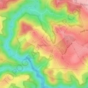
Name: Topografische Karte Davidson, Höhe, Relief.
Durchschnittliche Höhe: 98 m
Minimale Höhe: 6 m
Maximale Höhe: 178 m
Andere topografische Karten
Klicken Sie auf eine Karte, um ihre Topografie, ihre Höhe und ihr Relief anzuzeigen.
George Kendall Park Dog Off-Leash Area
Australia > New South Wales > Sydney
Durchschnittliche Höhe: 15 m