Geolokalisieren

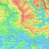
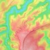
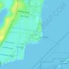
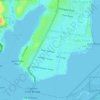
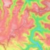
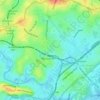
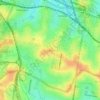
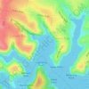
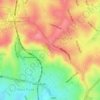
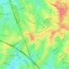
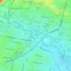
Topografische Karte Bayview Park

Klicken Sie auf die Karte, um die Höhe anzuzeigen.

Über diese Karte

Name: Topografische Karte Bayview Park, Höhe, Relief.

Ort: Bayview Park, Concord, Inner West, Sydney, City of Canada Bay Council, New South Wales, 2137, Australia (-33.85909 151.12036 -33.85669 151.12183)

Durchschnittliche Höhe: 10 m

Minimale Höhe: -2 m

Maximale Höhe: 34 m

Andere topografische Karten

Klicken Sie auf eine Karte, um ihre Topografie, ihre Höhe und ihr Relief anzuzeigen.
Wentworth Falls

Australia > New South Wales > Sydney

Wentworth Falls (postcode: 2782) is a town in the Blue Mountains region of New South Wales, situated approximately 100 kilometres (62 mi) west of the Sydney central business district, and about 8 kilometres (5.0 mi) east of Katoomba, Australia on the Great Western Highway, with a Wentworth Falls railway…

Durchschnittliche Höhe: 708 m
Lindfield

Australia > New South Wales > Sydney

Durchschnittliche Höhe: 79 m

Kurrajong Heights

Australia > New South Wales > Sydney

Durchschnittliche Höhe: 385 m

Iron Cove

Australia > New South Wales > Sydney

Durchschnittliche Höhe: 15 m

Sydney

Australia > New South Wales > Sydney

Durchschnittliche Höhe: 23 m

Ryde

Australia > New South Wales > Sydney

Durchschnittliche Höhe: 52 m

Northern Beaches

Australia > New South Wales > Sydney

Durchschnittliche Höhe: 67 m

Lower North Shore

Australia > New South Wales > Sydney

Durchschnittliche Höhe: 45 m

Randwick

Australia > New South Wales > Sydney

Durchschnittliche Höhe: 44 m

Liverpool

Australia > New South Wales > Sydney

Durchschnittliche Höhe: 14 m

Rouse Hill

Australia > New South Wales > Sydney

Durchschnittliche Höhe: 51 m

South Coogee

Australia > New South Wales > Sydney

Durchschnittliche Höhe: 30 m

Baulkham Hills

Australia > New South Wales > Sydney

Durchschnittliche Höhe: 93 m

Mount Kuring-Gai

Australia > New South Wales > Sydney

Mount Kuring-gai is located approximately 7 km north of Hornsby. Its neighbouring suburbs are Berowra to the north, and Mount Colah to the south. Surrounded by bushland, it is bordered by Ku-ring-gai Chase National Park on the eastern side and by Berowra Valley Regional Park on the western side. There are…

Durchschnittliche Höhe: 133 m
Mascot

Australia > New South Wales > Sydney

Durchschnittliche Höhe: 8 m

Engadine

Australia > New South Wales > Sydney

Durchschnittliche Höhe: 121 m

Pitt Town

Australia > New South Wales > Sydney

Durchschnittliche Höhe: 19 m

Blackwattle Bay

Australia > New South Wales > Sydney

Durchschnittliche Höhe: 15 m

Upper North Shore

Australia > New South Wales > Sydney

Durchschnittliche Höhe: 119 m

Dolls Point

Australia > New South Wales > Sydney

Durchschnittliche Höhe: 3 m

Mosman Bay

Australia > New South Wales > Sydney

Durchschnittliche Höhe: 41 m

Hurstville

Australia > New South Wales > Sydney

Durchschnittliche Höhe: 50 m

Macquarie Park

Australia > New South Wales > Sydney

Durchschnittliche Höhe: 59 m

Sans Souci

Australia > New South Wales > Sydney

Durchschnittliche Höhe: 4 m

Carlingford

Australia > New South Wales > Sydney

Durchschnittliche Höhe: 98 m

Galston

Australia > New South Wales > Sydney

Durchschnittliche Höhe: 167 m

Penrith

Australia > New South Wales > Sydney > Penrith

Penrith is a city in New South Wales, Australia, located in Greater Western Sydney, 55 kilometres (31 mi) west of the Sydney central business district on the banks of the Nepean River, on the outskirts of the Cumberland Plain. Its elevation is 32 metres (105 ft).

Durchschnittliche Höhe: 34 m
Crows Nest

Australia > New South Wales > Sydney

Durchschnittliche Höhe: 68 m

Eastwood

Australia > New South Wales > Sydney

Durchschnittliche Höhe: 80 m

Warragamba

Australia > New South Wales > Sydney

Durchschnittliche Höhe: 157 m

St Ives

Australia > New South Wales > Sydney

Durchschnittliche Höhe: 125 m

Palm Beach

Australia > New South Wales > Sydney

Durchschnittliche Höhe: 13 m

Sutherland Shire Council

Australia > New South Wales > Sydney

Durchschnittliche Höhe: 79 m

Mount Druitt

Australia > New South Wales > Sydney

Durchschnittliche Höhe: 52 m

Hornsby Heights

Australia > New South Wales > Sydney

Durchschnittliche Höhe: 146 m

Northbridge

Australia > New South Wales > Sydney

Durchschnittliche Höhe: 53 m

Cremorne

Australia > New South Wales > Sydney

Durchschnittliche Höhe: 54 m

Cronulla

Australia > New South Wales > Sydney

Durchschnittliche Höhe: 8 m

Austral

Australia > New South Wales > Sydney

Durchschnittliche Höhe: 73 m

Bondi Junction

Australia > New South Wales > Sydney

Durchschnittliche Höhe: 63 m

Marrickville

Australia > New South Wales > Sydney

Durchschnittliche Höhe: 17 m

Hornsby

Australia > New South Wales > Sydney

Durchschnittliche Höhe: 160 m

Cockatoo Island

Australia > New South Wales > Sydney

Durchschnittliche Höhe: 46 m

Menangle Park

Australia > New South Wales > Sydney

Durchschnittliche Höhe: 92 m

Bangor

Australia > New South Wales > Sydney

Durchschnittliche Höhe: 61 m

Echo Point

Australia > New South Wales > Sydney

Durchschnittliche Höhe: 725 m

Strathfield

Australia > New South Wales > Sydney

Durchschnittliche Höhe: 26 m

Villawood

Australia > New South Wales > Sydney

Durchschnittliche Höhe: 26 m

Willoughby

Australia > New South Wales > Sydney

Durchschnittliche Höhe: 80 m

Waterfall

Australia > New South Wales > Sydney

Durchschnittliche Höhe: 178 m

Ross Lookout

Australia > New South Wales > Sydney > Glenbrook

Durchschnittliche Höhe: 147 m

Darling Harbour

Australia > New South Wales > Sydney

Durchschnittliche Höhe: 23 m

North Wahroonga

Australia > New South Wales > Sydney

Durchschnittliche Höhe: 146 m

Gymea Bay

Australia > New South Wales > Sydney

Durchschnittliche Höhe: 29 m

Jamison Valley

Australia > New South Wales > Sydney > Leura

South of Mount Solitary, the valley sprawls through Cedar and Kedumba Valley down to Coxs River and Lake Burragorang, the lake that was created when Warragamba Dam was built. There is a 3 kilometres (1.9 mi) prohibited area around the river and lake to protect Sydney's water supply. Around this area there is a…

Durchschnittliche Höhe: 578 m

St George

Australia > New South Wales > Sydney

Durchschnittliche Höhe: 25 m

Eastern Suburbs

Australia > New South Wales > Sydney

Durchschnittliche Höhe: 12 m

Como West

Australia > New South Wales > Sydney

Durchschnittliche Höhe: 31 m

Moonrise Lookout

Australia > New South Wales > Sydney

Durchschnittliche Höhe: 95 m

Terry Road Lookout

Australia > New South Wales > Sydney

Durchschnittliche Höhe: 61 m

Erskineville

Australia > New South Wales > Sydney

Durchschnittliche Höhe: 21 m

Cottage Point

Australia > New South Wales > Sydney

Durchschnittliche Höhe: 62 m

Wakeley

Australia > New South Wales > Sydney

Durchschnittliche Höhe: 31 m

Denistone East

Australia > New South Wales > Sydney

Durchschnittliche Höhe: 66 m

Cabramatta West

Australia > New South Wales > Sydney

Durchschnittliche Höhe: 30 m

Greenacre

Australia > New South Wales > Sydney

Durchschnittliche Höhe: 36 m

Whipbird Gully

Australia > New South Wales > Sydney

Durchschnittliche Höhe: 111 m

Minto

Australia > New South Wales > Sydney

Durchschnittliche Höhe: 72 m

Pennant Hills

Australia > New South Wales > Sydney

The name Pennant Hills originally applied to the area now known as West Pennant Hills, located in the Hills District. However, when the northern railway line was built it passed through what is now Pennant Hills, so a suburb grew around the station and took on the name. The area around Thompsons Corner was…

Durchschnittliche Höhe: 146 m

Sylvania

Australia > New South Wales > Sydney

Durchschnittliche Höhe: 19 m

Scotland Island

Australia > New South Wales > Sydney

Durchschnittliche Höhe: 17 m

Woodford

Australia > New South Wales > Sydney

Woodford is a village in the Blue Mountains in New South Wales, Australia, about 90 kilometres west of Sydney. Its elevation is 609 metres (1,998 ft) above sea level. It is situated on the Great Western Highway and has a railway station (opened in 1868 as Buss's Platform) on the Main Western railway line…

Durchschnittliche Höhe: 544 m
Rockdale

Australia > New South Wales > Sydney

Durchschnittliche Höhe: 20 m

Bella Vista

Australia > New South Wales > Sydney

Durchschnittliche Höhe: 79 m

Waverton

Australia > New South Wales > Sydney

Durchschnittliche Höhe: 33 m

Berkshire Park

Australia > New South Wales > Sydney

Durchschnittliche Höhe: 27 m

St Leonards

Australia > New South Wales > Sydney

Durchschnittliche Höhe: 69 m

Denistone West

Australia > New South Wales > Sydney

Durchschnittliche Höhe: 55 m

Parsley Bay

Australia > New South Wales > Sydney > Brooklyn

Durchschnittliche Höhe: 20 m

Nelson

Australia > New South Wales > Sydney

Durchschnittliche Höhe: 47 m

Beaconsfield

Australia > New South Wales > Sydney

Durchschnittliche Höhe: 18 m

Shakespeare Drive Reserve

Australia > New South Wales > Sydney

Durchschnittliche Höhe: 51 m

Peak Hill

Australia > New South Wales > Sydney

Durchschnittliche Höhe: 58 m

Smithfield

Australia > New South Wales > Sydney

Established in 1836, Smithfield was the first major settlement of the Fairfield LGA. The original 1838 summary plan of Smithfield shows the suburb laid out in a grid pattern with most of the streets having the same names as they do today. Its altitude ranges from 21 to 48 m (69 to 157 ft) above sea level.…

Durchschnittliche Höhe: 33 m
Cronulla Point

Australia > New South Wales > Sydney

Durchschnittliche Höhe: 7 m

Holroyd

Australia > New South Wales > Sydney

Durchschnittliche Höhe: 24 m

Richmond Lowlands

Australia > New South Wales > Sydney

Durchschnittliche Höhe: 13 m

Oyster Bay

Australia > New South Wales > Sydney

Durchschnittliche Höhe: 25 m

Killarney Heights

Australia > New South Wales > Sydney

Durchschnittliche Höhe: 72 m

North Curl Curl

Australia > New South Wales > Sydney

Durchschnittliche Höhe: 22 m

Darlinghurst

Australia > New South Wales > Sydney

Durchschnittliche Höhe: 38 m

Mosman

Australia > New South Wales > Sydney

Durchschnittliche Höhe: 29 m

Marsfield

Australia > New South Wales > Sydney

Durchschnittliche Höhe: 72 m

Gregory Hills

Australia > New South Wales > Sydney

Gregory Hills is a suburb of Sydney in the state of New South Wales, Australia in Camden Council. The suburb was assigned on 1 August 2008. The suburb was named from the topography of the local area and from the original St Gregory's Chapel on the Marist Brothers land.

Durchschnittliche Höhe: 109 m
Oran Park

Australia > New South Wales > Sydney

Durchschnittliche Höhe: 93 m

Schofields

Australia > New South Wales > Sydney

Durchschnittliche Höhe: 32 m

Moorebank

Australia > New South Wales > Sydney

Durchschnittliche Höhe: 12 m

Killara

Australia > New South Wales > Sydney

Durchschnittliche Höhe: 86 m

Greystanes

Australia > New South Wales > Sydney

Durchschnittliche Höhe: 53 m

Cammeray

Australia > New South Wales > Sydney

Prior to the 1920s, the suburb was known as Suspension Bridge reflecting the now Long Gully Bridge that joined Northbridge to Cammeray. Cammeray was slow to develop mainly due to its steep topography and remoteness from transport.

Durchschnittliche Höhe: 66 m

Rüsten Sie sich für Ihr nächstes Abenteuer:

💧Tragbare Wasserfilter - Sicheres Trinkwasser aus Bächen und Seen
🥾Bergsteiger Ausrüstung Set - Komplettes Set für Bergexpeditionen
🧺Faltbare Sitzkissen - Trockene und warme Pausen auf jedem Untergrund
🔦Taschenlampe fürs Wandern - Kompakte und robuste Taschenlampe
🧭Profi-Marschkompasse - Präzise Spiegelkompasse für die klassische Geländenavigation

Als Amazon-Partner erhält diese Website eine Provision für qualifizierte Käufe, ohne zusätzliche Kosten für Sie.