Geolokalisieren

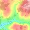
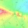
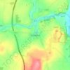
Topografische Karte Ballyhale

Klicken Sie auf die Karte, um die Höhe anzuzeigen.

Über diese Karte

Name: Topografische Karte Ballyhale, Höhe, Relief.

Ort: Ballyhale, The Municipal District of Callan — Thomastown, County Kilkenny, Leinster, Ireland (52.46281 -7.20385 52.47116 -7.19704)

Durchschnittliche Höhe: 81 m

Minimale Höhe: 42 m

Maximale Höhe: 177 m

Andere topografische Karten

Klicken Sie auf eine Karte, um ihre Topografie, ihre Höhe und ihr Relief anzuzeigen.
Walton's Bog

Ireland > County Kilkenny

Durchschnittliche Höhe: 66 m

Coon

Ireland > County Kilkenny

Durchschnittliche Höhe: 221 m

Brandon Hill

Ireland > County Kilkenny

Brandon Hill (Irish: Cnoc Bhréanail) is the highest mountain in County Kilkenny, Ireland, with an elevation of 515 m (1,690 ft) and prominence at 448 m (1,470 ft). The South Leinster Way, a long-distance trail, meandering through the Barrow Valley and traverses Brandon Hill. The village of Graiguenamanagh and…

Durchschnittliche Höhe: 294 m

Newmarket

Ireland > County Kilkenny > Newmarket

Durchschnittliche Höhe: 93 m

Jenkinstown Park

Ireland > County Kilkenny

Durchschnittliche Höhe: 77 m

Grangefertagh Round Tower

Ireland > County Kilkenny

Durchschnittliche Höhe: 121 m

Foyleatalure

Ireland > County Kilkenny

Durchschnittliche Höhe: 216 m

Windgap

Ireland > County Kilkenny

Durchschnittliche Höhe: 149 m

Finsboro

Ireland > County Kilkenny

Durchschnittliche Höhe: 163 m

Ballyfoyle

Ireland > County Kilkenny

Durchschnittliche Höhe: 120 m

Owning

Ireland > County Kilkenny

Durchschnittliche Höhe: 97 m

Stonyford

Ireland > County Kilkenny

Durchschnittliche Höhe: 64 m

Hugginstown

Ireland > County Kilkenny

Durchschnittliche Höhe: 129 m

Cloghogue

Ireland > County Kilkenny

Durchschnittliche Höhe: 152 m

Brandon Hill

Ireland > County Kilkenny

Brandon Hill (Irish: Cnoc Bhréanail) is the highest mountain in County Kilkenny, Ireland, with an elevation of 515 m (1,690 ft) and prominence at 448 m (1,470 ft). The South Leinster Way, a long-distance trail, meandering through the Barrow Valley and traverses Brandon Hill. The village of Graiguenamanagh and…

Durchschnittliche Höhe: 294 m
Mount Alto

Ireland > County Kilkenny

Durchschnittliche Höhe: 168 m

Rüsten Sie sich für Ihr nächstes Abenteuer:

🥄Titan-Besteck - Extrem leichtes und stabiles Essbesteck
🥾Bergsteiger Ausrüstung Set - Komplettes Set für Bergexpeditionen
🥾Wanderschuhe (Herren) - Robuste, wasserdichte Schuhe für anspruchsvolles Gelände
🧳Reisetasche mit Rollen - Große Reisetasche ideal für Outdoor‑Trips
🛠️Multitools - Der Werkzeugkasten für die Hosentasche

Als Amazon-Partner erhält diese Website eine Provision für qualifizierte Käufe, ohne zusätzliche Kosten für Sie.