
Topografische Karte Malton
Interaktive Karte
Klicken Sie auf die Karte, um die Höhe anzuzeigen.
Malton
As with the rest of the British Isles and Yorkshire, Malton possesses a maritime climate with cool summers and mild winters. The nearest Met Office weather station for which records are available is High Mowthorpe, about 6 miles (10 km) east of the town centre. Due to its lower elevation, the town centre is likely to be marginally warmer than High Mowthorpe throughout the year.
Über diese Karte
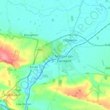
Name: Topografische Karte Malton, Höhe, Relief.
Durchschnittliche Höhe: 38 m
Minimale Höhe: 15 m
Maximale Höhe: 125 m