Geolokalisieren

Topografische Karte Kosciusko County

Interaktive Karte

Klicken Sie auf die Karte, um die Höhe anzuzeigen.

Über diese Karte

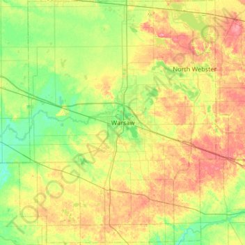
Name: Topografische Karte Kosciusko County, Höhe, Relief.

Ort: Kosciusko County, Indiana, USA (41.04135 -86.07769 41.43837 -85.65179)

Durchschnittliche Höhe: 262 m

Minimale Höhe: 233 m

Maximale Höhe: 306 m

Andere topografische Karten

Klicken Sie auf eine Karte, um ihre Topografie, ihre Höhe und ihr Relief anzuzeigen.

Griffith

USA > Indiana > Griffith

Griffith, Lake County, Indiana, 46319, USA

Durchschnittliche Höhe: 190 m

Middle Fork of Wildcat Creek

USA > Indiana

Middle Fork of Wildcat Creek, Clinton County, Indiana, 46065, USA

Durchschnittliche Höhe: 215 m

Mount Etna

USA > Indiana > Mount Etna

Mount Etna, Huntington County, Indiana, USA

Durchschnittliche Höhe: 245 m

Saturn

USA > Indiana > Saturn

Saturn, Whitley County, Indiana, USA

Durchschnittliche Höhe: 257 m

Pearl Island

USA > Indiana

Pearl Island, Gibson County, Indiana, USA

Durchschnittliche Höhe: 130 m