
Topografische Karte Villalba
Interaktive Karte
Klicken Sie auf die Karte, um die Höhe anzuzeigen.
Über diese Karte
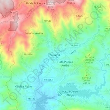
Name: Topografische Karte Villalba, Höhe, Relief.
Ort: Villalba, Puerto Rico, 00766, United States (18.08835 -66.53250 18.16835 -66.45250)
Durchschnittliche Höhe: 406 m
Minimale Höhe: 97 m
Maximale Höhe: 1.086 m
Villalba is located in the central region of Puerto Rico, on a valley in the Cordillera Central. The highest point in the municipality is Cerro El Bolo at 3,526 feet (1,075 m) of elevation.