
Topografische Karte Hilutungan Sanctuary
Interaktive Karte
Klicken Sie auf die Karte, um die Höhe anzuzeigen.
Über diese Karte
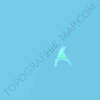
Name: Topografische Karte Hilutungan Sanctuary, Höhe, Relief.
Durchschnittliche Höhe: 0 m
Minimale Höhe: 0 m
Maximale Höhe: 4 m
Andere topografische Karten
Klicken Sie auf eine Karte, um ihre Topografie, ihre Höhe und ihr Relief anzuzeigen.
Olango Island
Philippines > Cebu > Lapu-Lapu
Olango Island, Lapu-Lapu, Cebu, Central Visayas, Philippines
Durchschnittliche Höhe: 2 m
Mactan
Philippines > Cebu > Lapu-Lapu
Mactan, Lapu-Lapu, Cebu, Central Visayas, Philippines
Durchschnittliche Höhe: 3 m
Gilutongan Island
Philippines > Cebu > Lapu-Lapu
Gilutongan Island, Lapu-Lapu, Cebu, Central Visayas, Philippines
Durchschnittliche Höhe: 0 m
Sulpa Islet
Philippines > Cebu > Lapu-Lapu
Sulpa Islet, Lapu-Lapu, Cebu, Central Visayas, Philippines
Durchschnittliche Höhe: 0 m