
Topografische Karte Anaktuvuk Pass
Interaktive Karte
Klicken Sie auf die Karte, um die Höhe anzuzeigen.
Über diese Karte
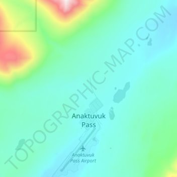
Name: Topografische Karte Anaktuvuk Pass, Höhe, Relief.
Durchschnittliche Höhe: 727 m
Minimale Höhe: 605 m
Maximale Höhe: 1.439 m
Andere topografische Karten
Klicken Sie auf eine Karte, um ihre Topografie, ihre Höhe und ihr Relief anzuzeigen.
Point Barrow
Estados Unidos da América > Alasca > North Slope
Point Barrow, North Slope, Alasca, Estados Unidos da América
Durchschnittliche Höhe: 0 m
Prudhoe Bay
Estados Unidos da América > Alasca > North Slope
Prudhoe Bay, North Slope, Alasca, 99734, Estados Unidos da América
Durchschnittliche Höhe: 10 m