
Topografische Karte Oxford
Interaktive Karte
Klicken Sie auf die Karte, um die Höhe anzuzeigen.
Über diese Karte
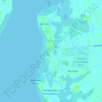
Name: Topografische Karte Oxford, Höhe, Relief.
Ort: Oxford, Talbot County, Maryland, United States (38.67096 -76.17693 38.69661 -76.16243)
Durchschnittliche Höhe: 1 m
Minimale Höhe: -1 m
Maximale Höhe: 8 m
Andere topografische Karten
Klicken Sie auf eine Karte, um ihre Topografie, ihre Höhe und ihr Relief anzuzeigen.
Wye Oak State Park
United States > Maryland > Talbot County
Wye Oak State Park, Talbot County, Maryland, United States
Durchschnittliche Höhe: 14 m
Tilghman Island
United States > Maryland > Talbot County > Tilghman Island
Tilghman Island, Talbot County, Maryland, United States
Durchschnittliche Höhe: 0 m
Golton
United States > Maryland > Talbot County > Easton
Golton, Easton, Talbot County, Maryland, 21601, United States
Durchschnittliche Höhe: 16 m
Tilghman Island
United States > Maryland > Talbot County
Tilghman Island, Talbot County, Maryland, 21671, United States
Durchschnittliche Höhe: 1 m
McDaniel
United States > Maryland > Talbot County
McDaniel, Talbot County, Maryland, 21624, United States
Durchschnittliche Höhe: 2 m
Carters Plains
United States > Maryland > Talbot County > Easton
Carters Plains, Easton, Talbot County, Maryland, 21601, United States
Durchschnittliche Höhe: 15 m
Trappe
United States > Maryland > Talbot County
Trappe, Talbot County, Maryland, 21673, United States
Durchschnittliche Höhe: 13 m
St. Michaels
United States > Maryland > Talbot County
St. Michaels, Talbot County, Maryland, 21663, United States
Durchschnittliche Höhe: 2 m
Bozman
United States > Maryland > Talbot County > Bozman
Bozman, Talbot County, Maryland, 21612, United States
Durchschnittliche Höhe: 2 m
Canterbury
United States > Maryland > Talbot County > Canterbury
Canterbury, Talbot County, Maryland, United States
Durchschnittliche Höhe: 4 m
Easton
United States > Maryland > Talbot County
Easton, Talbot County, Maryland, 21601, United States
Durchschnittliche Höhe: 10 m