
Topografische Karte Santo Domingo Ocotitlán
Interaktive Karte
Klicken Sie auf die Karte, um die Höhe anzuzeigen.
Über diese Karte
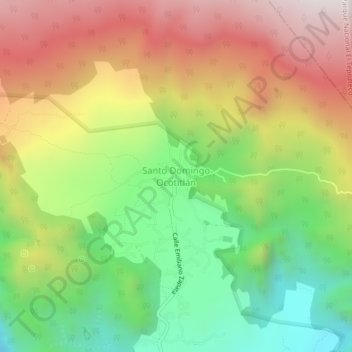
Name: Topografische Karte Santo Domingo Ocotitlán, Höhe, Relief.
Ort: Santo Domingo Ocotitlán, Tepoztlán, Morelos, 62523, Mexico (18.99386 -99.08102 19.03386 -99.04102)
Durchschnittliche Höhe: 2.249 m
Minimale Höhe: 1.752 m
Maximale Höhe: 2.815 m