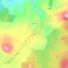
Topografische Karte Newcomb
Klicken Sie auf die Karte, um die Höhe anzuzeigen.
Über diese Karte

Name: Topografische Karte Newcomb, Höhe, Relief.
Durchschnittliche Höhe: 7 m
Minimale Höhe: -2 m
Maximale Höhe: 37 m
Andere topografische Karten
Klicken Sie auf eine Karte, um ihre Topografie, ihre Höhe und ihr Relief anzuzeigen.


Ballarat
Ballarat has a moderate oceanic climate (Köppen climate classification Cfb) with four distinct seasons. Its elevation, ranging between 400 and 630 metres (1,310 and 2,070 feet) above sea level, causes its mean monthly temperatures to tend to be on average 3 to 5 °C (5 to 9 °F) below those of Melbourne,…
Durchschnittliche Höhe: 470 m




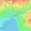
Melbourne
Melbourne is also prone to isolated convective showers forming when a cold pool crosses the state, especially if there is considerable daytime heating. These showers are often heavy and can include hail, squalls, and significant drops in temperature, but they often pass through very quickly with a rapid…
Durchschnittliche Höhe: 49 m


Mount Noorat
Mount Noorat is a major volcano of the Newer Volcanics Province of Victoria, with a peak height of 310 metres above sea level and a crater between 160 and 200 metres. It is characterised by multiple vents, a complex topography, and the deepest scoria enclosed crater in Victoria. The mount illustrates a…
Durchschnittliche Höhe: 176 m




Frankston
Australia > Victoria > Frankston
Olivers Hill is the most prominent elevation in Frankston which rises to 55 metres above sea level (180 feet) at its highest point in the suburb. Its origins date to approximately 415 to 360 million years ago. Its base is Mount Eliza Granite dating from the Devonian period, which was covered in lava tuffs in…
Durchschnittliche Höhe: 36 m









Castlemaine
The Castlemaine goldfields' legendary prosperity raised expectations of Castlemaine becoming Victoria's second city. That is reflected in imposing buildings erected in the town's first few years. Though the rich alluvial diggings were largely exhausted within 15-20 years causing the town's population to shrink…
Durchschnittliche Höhe: 331 m



Mount Warrenheip
Mount Warrenheip /wɒrənˈhiːp/ (Wathawarrung: Warrengeep) is an inactive scoria volcanic cone in Victoria, Australia. The mountain has an elevation of 746 metres (2,448 ft) AHD. A landmark of Dunnstown, the closest town, the mountain is 9 kilometres (5.6 mi) east of the Ballarat central business district,…
Durchschnittliche Höhe: 576 m