Geolokalisieren

Topografische Karte Bibi

Interaktive Karte

Klicken Sie auf die Karte, um die Höhe anzuzeigen.

Über diese Karte

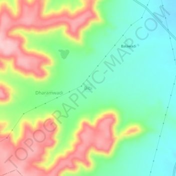
Name: Topografische Karte Bibi, Höhe, Relief.

Ort: Bibi, Pusad, Yavatmal District, Maharashtra, India (19.75801 77.56832 19.79801 77.60832)

Durchschnittliche Höhe: 417 m

Minimale Höhe: 339 m

Maximale Höhe: 526 m

Andere topografische Karten

Klicken Sie auf eine Karte, um ihre Topografie, ihre Höhe und ihr Relief anzuzeigen.

Parwa

India > Maharashtra > Pusad

Parwa, Pusad, Yavatmal District, Maharashtra, India

Durchschnittliche Höhe: 424 m

Harshi

India > Maharashtra > Pusad

Harshi, Pusad, Yavatmal District, Maharashtra, India

Durchschnittliche Höhe: 373 m

Nagwadi

India > Maharashtra > Pusad

Nagwadi, Pusad, Yavatmal District, Maharashtra, India

Durchschnittliche Höhe: 427 m

Dahiwad

India > Maharashtra > Pusad

Dahiwad, Pusad, Yavatmal District, Maharashtra, India

Durchschnittliche Höhe: 329 m

Asoli

India > Maharashtra > Pusad

Asoli, Pusad, Yavatmal District, Maharashtra, India

Durchschnittliche Höhe: 336 m

Shilona

India > Maharashtra > Pusad

Shilona, Pusad, Yavatmal District, Maharashtra, India

Durchschnittliche Höhe: 374 m

Kharshi

India > Maharashtra > Pusad

Kharshi, Pusad, Yavatmal, Maharashtra, India

Durchschnittliche Höhe: 405 m

Panhala

India > Maharashtra > Pusad

Panhala, Pusad, Yavatmal, Maharashtra, India

Durchschnittliche Höhe: 541 m