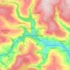
Topografische Karte Bristol
Klicken Sie auf die Karte, um die Höhe anzuzeigen.
Über diese Karte

Name: Topografische Karte Bristol, Höhe, Relief.
Ort: Bristol, West of England, England, United Kingdom (51.34163 -3.11782 51.54443 -2.51042)
Durchschnittliche Höhe: 80 m
Minimale Höhe: -2 m
Maximale Höhe: 323 m
Andere topografische Karten
Klicken Sie auf eine Karte, um ihre Topografie, ihre Höhe und ihr Relief anzuzeigen.
Burton upon Trent
United Kingdom > England > Staffordshire > East Staffordshire
Burton is about 109 miles (175 km) north west of London, about 30 miles north east of Birmingham, the UK's second largest city and about 23 miles east of the county town Stafford. It is at the easternmost border of the county of Staffordshire with Derbyshire, its suburbs and the course of the River Trent…
Durchschnittliche Höhe: 69 m
Leeds
Lying in the eastern foothills of the Pennines, there is a significant variation in elevation within the city's built-up area. The district ranges from 1,115 feet (340 m) in the far west on the slopes of Ilkley Moor to about 33 feet (10 m) where the rivers Aire and Wharfe cross the eastern boundary. Land rises…
Durchschnittliche Höhe: 94 m
Salisbury
United Kingdom > England > Salisbury
Bishop of Salisbury Hubert Walter was instrumental in the negotiations with Saladin during the Third Crusade, but he spent little time in his diocese prior to his elevation to archbishop of Canterbury. The brothers Herbert and Richard Poore succeeded him and began planning the relocation of the cathedral into…
Durchschnittliche Höhe: 96 m


Blackwell
United Kingdom > England > Worcestershire > Bromsgrove > Blackwell
Durchschnittliche Höhe: 162 m


Nuneaton
United Kingdom > England > Warwickshire > Nuneaton and Bedworth
Durchschnittliche Höhe: 102 m
Hull
United Kingdom > England > Kingston upon Hull
Kingston upon Hull is on the northern bank of the Humber Estuary. The city centre is west of the River Hull and close to the Humber. The city is built upon alluvial and glacial deposits which overlie chalk rocks but the underlying chalk has no influence on the topography. The land within the city is generally…
Durchschnittliche Höhe: 21 m

Reading
United Kingdom > England > Reading
Mary Russell Mitford lived in Reading for a number of years and then spent the rest of her life just outside the town at Three Mile Cross and Swallowfield. The fictional Belford Regis of her eponymous novel, first published in 1835, is largely based on Reading. Described with topographical accuracy, it is…
Durchschnittliche Höhe: 56 m
Swindon
United Kingdom > England > Swindon
Swindon has an oceanic climate (Cfb in the Köppen climate classification), like the vast majority of the British Isles, with cool winters and warm summers. The nearest official weather station is RAF Lyneham, about 10 miles (16 km) west southwest of Swindon town centre. The weather station's elevation is 145…
Durchschnittliche Höhe: 108 m

Salford
At 53°28′59″N 2°17′35″W / 53.48306°N 2.29306°W / 53.48306; -2.29306 (53.483°, −2.2931°), and 205 miles (330 km) northwest of central London, Salford stands about 177 feet (54 m) above sea level, on relatively flat ground to the west of a meander of the River Irwell – the city's main…
Durchschnittliche Höhe: 106 m


Harriseahead
United Kingdom > England > Staffordshire > Newcastle-under-Lyme
Durchschnittliche Höhe: 200 m
Northleach
United Kingdom > England > Gloucestershire > Cotswold District
Durchschnittliche Höhe: 179 m
Gateshead
United Kingdom > England > Tyne and Wear > Gateshead
One of the most distinguishing features of Gateshead is its topography. The land rises 230 feet (70 m) from Gateshead Quays to the town centre and continues rising to a height of 525 feet (160 m) at Queen Elizabeth Hospital in Sheriff Hill. This is in contrast to the flat and low lying Team Valley located on…
Durchschnittliche Höhe: 62 m




Hinckley
United Kingdom > England > Leicestershire > Hinckley and Bosworth
Durchschnittliche Höhe: 105 m
Cambridge
United Kingdom > England > Cambridge
The city, like most of the UK, has a maritime climate highly influenced by the Gulf Stream. Located in the driest region of Britain, Cambridge's rainfall averages around 570 mm (22.44 in) per year, around half the national average, with some years occasionally falling into the semi-arid (under 500 mm (19.69…
Durchschnittliche Höhe: 18 m
St Albans
United Kingdom > England > Hertfordshire > St Albans
St Albans was an ancient borough created following the dissolution of the monastery in 1539. It consisted of the ancient parish of St Albans (also known as the Abbey parish) and parts of St Michael and St Peter. The municipal corporation was reformed by the Municipal Corporations Act 1835 and the boundary was…
Durchschnittliche Höhe: 100 m
Croydon
United Kingdom > England > Greater London
Several apartment developments, for instance Altitude 25 (completed 2010), have been built in recent years, and several more are being built or planned. The construction of Saffron Square, which includes a 43-storey tower, began on Wellesley Road in 2011 and was completed in 2016. Other developments with…
Durchschnittliche Höhe: 68 m
Talbot Village
United Kingdom > England > Bournemouth, Christchurch and Poole
Durchschnittliche Höhe: 40 m

Devitts Green
United Kingdom > England > Warwickshire > North Warwickshire > Old Arley
Durchschnittliche Höhe: 131 m






Scarborough
United Kingdom > England > North Yorkshire
The climate is temperate with mild summers and cool, windy, winters. The hottest months of the year are July and August, with temperatures reaching an average high of 17 °C and falling to 11 °C at night. The average daytime temperatures in January are 4 °C, falling to 1 °C at night. The station's elevation…
Durchschnittliche Höhe: 39 m

Windmill Hill
United Kingdom > England > Hertfordshire > North Hertfordshire > Hitchin
Durchschnittliche Höhe: 74 m

Oldham
United Kingdom > England > Oldham
By 1756, Oldham had emerged as centre of the hatting industry in England. The rough felt used in the production process is the origin of the term "Owdham Roughyed" a nickname for people from Oldham. It was not until the last quarter of the 18th century that Oldham changed from being a cottage industry township…
Durchschnittliche Höhe: 173 m

Featherstone Colliery
United Kingdom > England > Wakefield > Featherstone > Snydale
Durchschnittliche Höhe: 44 m



Harrow
United Kingdom > England > London Borough of Harrow > Harrow
The town centre is about 220 feet (67 m) above sea level, almost 200 feet (61 m) below the top of Harrow Hill, which is an outlying knoll. The hill is half a mile south of the town centre, and the settlement is rich with historic architecture and has a village atmosphere. The steep climb towards the hill is…
Durchschnittliche Höhe: 57 m


Chalford Hill
United Kingdom > England > Gloucestershire > Stroud > Chalford
Durchschnittliche Höhe: 175 m
Pitsford Water
United Kingdom > England > West Northamptonshire > Pitsford
Durchschnittliche Höhe: 108 m






Morpeth
United Kingdom > England > Morpeth
Cockle Park, located slightly north of Morpeth, contains a Met Office weather station, founded in 1897. The following table shows the climate data of the station from 1971–2000, recorded at 95 metres (312 ft) elevation.
Durchschnittliche Höhe: 70 m
Weston-super-Mare
United Kingdom > England > North Somerset > Weston-super-Mare
Durchschnittliche Höhe: 13 m