
Topografische Karte Santurtzi
Interaktive Karte
Klicken Sie auf die Karte, um die Höhe anzuzeigen.
Santurtzi
Santurtzi has a very rough orography although excluding Mount Serantes (452m) - one of its most symbolic topographic elements, it is not at high altitude, the significant heights being spurs of the Serantes (Serandi): The Mallet (245m) and the Fortified heights (123 and 106m). Its relief is within the north flank of the anticline of Biscay. It is a relief of a structural type corresponding to a series of materials of the Cretaceous period (limestone) throughout Punta Lucero-Serantes smoothly inclined towards the Estuary of Bilbao.
Über diese Karte
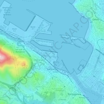
Name: Topografische Karte Santurtzi, Höhe, Relief.
Durchschnittliche Höhe: 34 m
Minimale Höhe: -3 m
Maximale Höhe: 360 m