
Topografische Karte West Lima
Interaktive Karte
Klicken Sie auf die Karte, um die Höhe anzuzeigen.
Über diese Karte
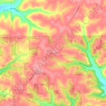
Name: Topografische Karte West Lima, Höhe, Relief.
Durchschnittliche Höhe: 367 m
Minimale Höhe: 290 m
Maximale Höhe: 398 m
Andere topografische Karten
Klicken Sie auf eine Karte, um ihre Topografie, ihre Höhe und ihr Relief anzuzeigen.
Richland Center
United States > Wisconsin > Richland County
Richland Center, Richland County, Wisconsin, 53581, United States
Durchschnittliche Höhe: 264 m
Loyd
United States > Wisconsin > Richland County
Loyd, Town of Willow, Richland County, Wisconsin, United States
Durchschnittliche Höhe: 291 m
Gotham
United States > Wisconsin > Richland County
Gotham, Town of Buena Vista, Richland County, Wisconsin, 53540, United States
Durchschnittliche Höhe: 221 m