
Topografische Karte Donnelly
Interaktive Karte
Klicken Sie auf die Karte, um die Höhe anzuzeigen.
Donnelly
Donnelly is located at 44°43′49″N 116°4′37″W / 44.73028°N 116.07694°W / 44.73028; -116.07694, at an elevation of 4,865 feet (1,483 m) above sea level. According to the United States Census Bureau, the city has a total area of 0.45 square miles (1.17 km2), all of it land.
Über diese Karte
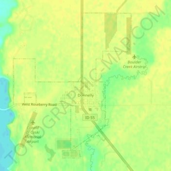
Name: Topografische Karte Donnelly, Höhe, Relief.
Ort: Donnelly, Valley County, Idaho, United States (44.72257 -116.09364 44.74549 -116.06739)
Durchschnittliche Höhe: 1.483 m
Minimale Höhe: 1.469 m
Maximale Höhe: 1.488 m
Andere topografische Karten
Klicken Sie auf eine Karte, um ihre Topografie, ihre Höhe und ihr Relief anzuzeigen.