
Topografische Karte Gundagai
Interaktive Karte
Klicken Sie auf die Karte, um die Höhe anzuzeigen.
Über diese Karte
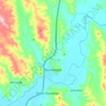
Name: Topografische Karte Gundagai, Höhe, Relief.
Durchschnittliche Höhe: 309 m
Minimale Höhe: 208 m
Maximale Höhe: 622 m
Gundagai is an inland town with an elevation of 250 metres (820 ft). Almost all of the shire is located in the South West Slopes bio-region and is part of the Riverina agricultural region. The eastern part of the shire is considered part of the South Eastern Highlands bioregion.