
Topografische Karte Ford County
Interaktive Karte
Klicken Sie auf die Karte, um die Höhe anzuzeigen.
Über diese Karte
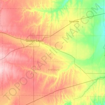
Name: Topografische Karte Ford County, Höhe, Relief.
Ort: Ford County, Kansas, United States (37.46887 -100.22753 37.91499 -99.55573)
Durchschnittliche Höhe: 761 m
Minimale Höhe: 685 m
Maximale Höhe: 843 m
Andere topografische Karten
Klicken Sie auf eine Karte, um ihre Topografie, ihre Höhe und ihr Relief anzuzeigen.
Stanton County
Stanton County, Kansas, United States
Durchschnittliche Höhe: 1.031 m
Shawnee County
Shawnee County, Kansas, United States
Durchschnittliche Höhe: 315 m
Longford
United States > Kansas > Clay County > Longford
Longford, Clay County, Kansas, United States
Durchschnittliche Höhe: 407 m