
Topografische Karte Ituiutaba
Interaktive Karte
Klicken Sie auf die Karte, um die Höhe anzuzeigen.
Ituiutaba
Ituiutaba (Brazilian Portuguese: /itujuˈtabɐ/) is a municipality in the western part of Minas Gerais state, Brazil. Elevated to city status in 1901, its population in 2020 was 105,255 and a total area in the municipality of 2,694 km2. The elevation of the seat of the municipality is 544 m.
Über diese Karte
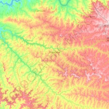
Name: Topografische Karte Ituiutaba, Höhe, Relief.
Durchschnittliche Höhe: 581 m
Minimale Höhe: 398 m
Maximale Höhe: 795 m