
Topografische Karte Timmins Drain
Interaktive Karte
Klicken Sie auf die Karte, um die Höhe anzuzeigen.
Über diese Karte
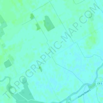
Name: Topografische Karte Timmins Drain, Höhe, Relief.
Durchschnittliche Höhe: 72 m
Minimale Höhe: 69 m
Maximale Höhe: 76 m
Andere topografische Karten
Klicken Sie auf eine Karte, um ihre Topografie, ihre Höhe und ihr Relief anzuzeigen.
Ormond
Canada > Ontario > Stormont, Dundas and Glengarry Counties > North Dundas
Ormond, North Dundas, Stormont, Dundas and Glengarry Counties, Eastern Ontario, Ontario, Canada
Durchschnittliche Höhe: 77 m
Winchester
Canada > Ontario > Stormont, Dundas and Glengarry Counties > North Dundas
Winchester, North Dundas, Stormont, Dundas and Glengarry Counties, Eastern Ontario, Ontario, K0C 2K0, Canada
Durchschnittliche Höhe: 76 m
Hallville
Canada > Ontario > Stormont, Dundas and Glengarry Counties > North Dundas
Hallville, North Dundas, Stormont, Dundas and Glengarry Counties, Eastern Ontario, Ontario, Canada
Durchschnittliche Höhe: 91 m
Chesterville
Canada > Ontario > Stormont, Dundas and Glengarry Counties > North Dundas
Chesterville, North Dundas, Stormont, Dundas and Glengarry Counties, Eastern Ontario, Ontario, K0C 1H0, Canada
Durchschnittliche Höhe: 74 m