
Topografische Karte Akamaru
Interaktive Karte
Klicken Sie auf die Karte, um die Höhe anzuzeigen.
Akamaru
Akamaru is the third largest island in the Gambier Islands of French Polynesia. It is a small, rocky island with an area of approximately 2.6 km2 (1.0 sq mi). The island is located approximately 7 km (4.3 mi) southeast of Mangareva. Its highest point rises to an elevation of 247 m (810 ft).
Über diese Karte
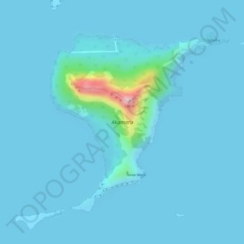
Name: Topografische Karte Akamaru, Höhe, Relief.
Durchschnittliche Höhe: 15 m
Minimale Höhe: 0 m
Maximale Höhe: 242 m
Andere topografische Karten
Klicken Sie auf eine Karte, um ihre Topografie, ihre Höhe und ihr Relief anzuzeigen.