
Topografische Karte Zacatelco
Interaktive Karte
Klicken Sie auf die Karte, um die Höhe anzuzeigen.
Zacatelco
Zacatelco is located in the southern part of the valley of Tlaxcala, on the border with the state of Puebla, is at an altitude of 2,210 meters above sea level, making it one of the highest cities in Mexico. It is located just 11.9 km from the state capital, 27.1 km from the city of Puebla and 121.8 km from Mexico City.
Über diese Karte
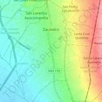
Name: Topografische Karte Zacatelco, Höhe, Relief.
Ort: Zacatelco, Tlaxcala, Mexico (19.17436 -98.26083 19.23270 -98.23024)
Durchschnittliche Höhe: 2.215 m
Minimale Höhe: 2.181 m
Maximale Höhe: 2.278 m