Geolokalisieren

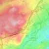
Topografische Karte Signal Hill

Klicken Sie auf die Karte, um die Höhe anzuzeigen.

Über diese Karte

Name: Topografische Karte Signal Hill, Höhe, Relief.

Ort: Signal Hill, St. John's, Newfoundland, Newfoundland and Labrador, A1A 3T3, Canada (47.57208 -52.68042 47.57218 -52.68032)

Durchschnittliche Höhe: 28 m

Minimale Höhe: -1 m

Maximale Höhe: 175 m

Andere topografische Karten

Klicken Sie auf eine Karte, um ihre Topografie, ihre Höhe und ihr Relief anzuzeigen.
Pippy Park

Canada > Newfoundland and Labrador > St. John's

Durchschnittliche Höhe: 129 m

Shea Heights

Canada > Newfoundland and Labrador > St. John's

Durchschnittliche Höhe: 131 m

Signal Hill

Canada > Newfoundland and Labrador > St. John's

Durchschnittliche Höhe: 34 m

Airport Heights

Canada > Newfoundland and Labrador > St. John's

Durchschnittliche Höhe: 160 m

Cowan Heights

Canada > Newfoundland and Labrador > St. John's

Durchschnittliche Höhe: 112 m

Downtown

Canada > Newfoundland and Labrador > St. John's

Durchschnittliche Höhe: 56 m

Stavanger Drive

Canada > Newfoundland and Labrador > St. John's

Durchschnittliche Höhe: 104 m

Robin Hood Bay

Canada > Newfoundland and Labrador > St. John's

Durchschnittliche Höhe: 48 m

Pennywell

Canada > Newfoundland and Labrador > St. John's

Durchschnittliche Höhe: 66 m

Rüsten Sie sich für Ihr nächstes Abenteuer:

🧨Signalpfeife - Nützlicher SOS Signalgeber für Wanderungen
🔭Monokulare - Ultrakompakte Optik für die schnelle Orientierung
🏕️Camping Hängematte - Leichte Hängematte für Outdoor Ruhepausen
🥤Thermoskanne Outdoor - Isolierte Thermoskanne für heiße/kalte Getränke
🧠Outdoor Führer Bücher - Reiseführer und Wanderführer Deutschland

Als Amazon-Partner erhält diese Website eine Provision für qualifizierte Käufe, ohne zusätzliche Kosten für Sie.