
Topografische Karte Polatlı
Interaktive Karte
Klicken Sie auf die Karte, um die Höhe anzuzeigen.
Über diese Karte
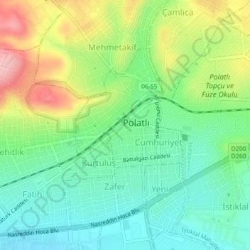
Name: Topografische Karte Polatlı, Höhe, Relief.
Durchschnittliche Höhe: 889 m
Minimale Höhe: 833 m
Maximale Höhe: 988 m
Polatlı (formerly Ancient Greek: Γόρδιον, Górdion and Latin: Gordium) is a city and a district in Ankara Province in the Central Anatolia region of Turkey, 80 km west of the Turkish capital Ankara, on the road to Eskişehir. According to 2019 census, population of the district is 125,075 of which 98,605 live in the city of Polatlı. The district covers an area of 3,789 km2, and the average elevation is 850 m.
Andere topografische Karten
Klicken Sie auf eine Karte, um ihre Topografie, ihre Höhe und ihr Relief anzuzeigen.
Karacaahmet
Karacaahmet, Polatlı, Ankara, Central Anatolia Region, Turkey
Durchschnittliche Höhe: 683 m
Yassıhüyük
Yassıhüyük, Polatlı, Ankara, Central Anatolia Region, Turkey
Durchschnittliche Höhe: 698 m