
Topografische Karte Tarfaya
Interaktive Karte
Klicken Sie auf die Karte, um die Höhe anzuzeigen.
Über diese Karte
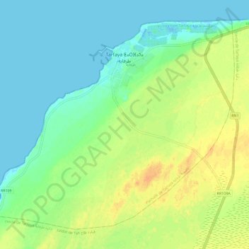
Name: Topografische Karte Tarfaya, Höhe, Relief.
Durchschnittliche Höhe: 12 m
Minimale Höhe: -2 m
Maximale Höhe: 30 m
Sebkha Tah, the lowest altitude point in Morocco (55 meters below sea level) is located in Tarfaya province. Tarfaya is also the closest city to the Khenifiss National Park, added to the UNESCO World Heritage Tentative list, an ecological site home to hundreds of different kinds of migratory birds each year. It is estimated that more than 20,000 birds from 211 different species breed, nest and feed regularly in the park.