
Topografische Karte Bidar
Klicken Sie auf die Karte, um die Höhe anzuzeigen.
Bidar
Bidar is located at 17°54′N 77°30′E / 17.9°N 77.5°E / 17.9; 77.5, lies at a central position in Deccan, a plateau at an elevation of 2300 ft from the sea level. It has common boundaries with Maharashtra and Telangana which is, with the districts of Nizamabad and Medak in Telangana on the East and the districts of Latur, Nanded and Osmanabad in Maharashtra on the west. On the south lies the district Gulbarga of Karnataka.
Über diese Karte
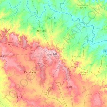
Name: Topografische Karte Bidar, Höhe, Relief.
Ort: Bidar, Bidar taluku, Bidar, Karnataka, 585400, India (17.75438 77.36636 18.07438 77.68636)
Durchschnittliche Höhe: 593 m
Minimale Höhe: 520 m
Maximale Höhe: 680 m