
Topografische Karte Karoo Hoogland Local Municipality
Interaktive Karte
Klicken Sie auf die Karte, um die Höhe anzuzeigen.
Über diese Karte
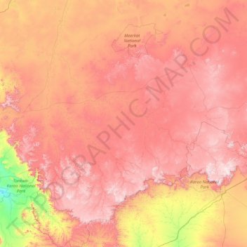
Name: Topografische Karte Karoo Hoogland Local Municipality, Höhe, Relief.
Durchschnittliche Höhe: 1.101 m
Minimale Höhe: 307 m
Maximale Höhe: 1.942 m
Andere topografische Karten
Klicken Sie auf eine Karte, um ihre Topografie, ihre Höhe und ihr Relief anzuzeigen.
Fraserburg
South Africa > Northern Cape > Namakwa District Municipality > Karoo Hoogland Local Municipality
Fraserburg, Karoo Hoogland Local Municipality, Namakwa District Municipality, Northern Cape, 6960, South Africa
Durchschnittliche Höhe: 1.268 m