
Topografische Karte West Head
Interaktive Karte
Klicken Sie auf die Karte, um die Höhe anzuzeigen.
Über diese Karte
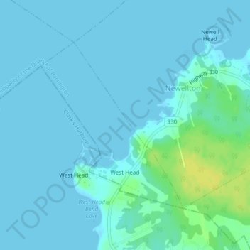
Name: Topografische Karte West Head, Höhe, Relief.
Durchschnittliche Höhe: 3 m
Minimale Höhe: -1 m
Maximale Höhe: 19 m
Andere topografische Karten
Klicken Sie auf eine Karte, um ihre Topografie, ihre Höhe und ihr Relief anzuzeigen.
Sandy Point
Canada > Nova Scotia > Shelburne County
Sandy Point, Municipality of the District of Shelburne, Shelburne County, Nova Scotia, B0T 1W0, Canada
Durchschnittliche Höhe: 23 m
Barrington Passage
Canada > Nova Scotia > Shelburne County > Barrington Passage
Barrington Passage, Municipality of the District of Barrington, Shelburne County, Nova Scotia, B0W 1E0, Canada
Durchschnittliche Höhe: 13 m
Rocky Creek
Canada > Nova Scotia > Shelburne County > Lower Clyde River
Rocky Creek, Lower Clyde River, Municipality of the District of Barrington, Shelburne County, Nova Scotia, B0W 1R0, Canada
Durchschnittliche Höhe: 48 m
Blacksmiths Beach
Canada > Nova Scotia > Shelburne County > Cape Negro Island
Blacksmiths Beach, Cape Negro Island, Municipality of the District of Barrington, Shelburne County, Nova Scotia, B0W 1K0, Canada
Durchschnittliche Höhe: 2 m