
Topografische Karte Oostzanerveld
Interaktive Karte
Klicken Sie auf die Karte, um die Höhe anzuzeigen.
Über diese Karte
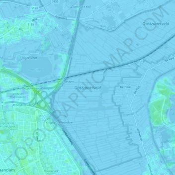
Name: Topografische Karte Oostzanerveld, Höhe, Relief.
Durchschnittliche Höhe: 0 m
Minimale Höhe: -7 m
Maximale Höhe: 7 m
Andere topografische Karten
Klicken Sie auf eine Karte, um ihre Topografie, ihre Höhe und ihr Relief anzuzeigen.
Zaanse Schans
Nederland > Noord-Holland > Zaanstad > Zaanse Schans
Zaanse Schans, Zaanstad, Noord-Holland, Nederland, 1509, Nederland
Durchschnittliche Höhe: 0 m
Zaan
Nederland > Noord-Holland > Zaanstad
Zaan, Zaanstad, Noord-Holland, Nederland, 1502AB, Nederland
Durchschnittliche Höhe: 2 m
Zaan
Nederland > Noord-Holland > Zaanstad
Zaan, Zaanstad, Noord-Holland, Nederland, 1502AB, Nederland
Durchschnittliche Höhe: 2 m
Indijk
Nederland > Noord-Holland > Zaanstad
Indijk, Zaanstad, Noord-Holland, Nederland, 1562GK, Nederland
Durchschnittliche Höhe: 0 m