
Topografische Karte Yegen
Interaktive Karte
Klicken Sie auf die Karte, um die Höhe anzuzeigen.
Über diese Karte
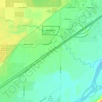
Name: Topografische Karte Yegen, Höhe, Relief.
Ort: Yegen, Yellowstone County, Montana, United States (45.70356 -108.64264 45.74356 -108.60264)
Durchschnittliche Höhe: 981 m
Minimale Höhe: 965 m
Maximale Höhe: 1.007 m
Andere topografische Karten
Klicken Sie auf eine Karte, um ihre Topografie, ihre Höhe und ihr Relief anzuzeigen.
Billings
United States > Montana > Yellowstone County
Billings, Yellowstone County, Montana, United States
Durchschnittliche Höhe: 1.023 m
Huntley
United States > Montana > Yellowstone County
Huntley, Yellowstone County, Montana, United States
Durchschnittliche Höhe: 924 m
Laurel
United States > Montana > Yellowstone County
Laurel, Yellowstone County, Montana, United States
Durchschnittliche Höhe: 1.019 m