
Topografische Karte North Olmsted
Interaktive Karte
Klicken Sie auf die Karte, um die Höhe anzuzeigen.
Über diese Karte
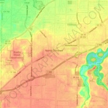
Name: Topografische Karte North Olmsted, Höhe, Relief.
Durchschnittliche Höhe: 229 m
Minimale Höhe: 197 m
Maximale Höhe: 243 m
Andere topografische Karten
Klicken Sie auf eine Karte, um ihre Topografie, ihre Höhe und ihr Relief anzuzeigen.
Highland Heights
États-Unis d'Amérique > Ohio > Cuyahoga County
Highland Heights, Cuyahoga County, Ohio, 44143, États-Unis d'Amérique
Durchschnittliche Höhe: 289 m
Cleveland
États-Unis d'Amérique > Ohio > Cuyahoga County > Cleveland
Cleveland, Cuyahoga County, Ohio, 44114, États-Unis d'Amérique
Durchschnittliche Höhe: 219 m
Brecksville
États-Unis d'Amérique > Ohio > Cuyahoga County
Brecksville, Cuyahoga County, Ohio, 44141, États-Unis d'Amérique
Durchschnittliche Höhe: 292 m