
Spenden
Rüsten Sie sich für Ihr nächstes Abenteuer:
Als Amazon-Partner erhält diese Website eine Provision für qualifizierte Käufe, ohne zusätzliche Kosten für Sie.
Topografische Karte Anahim Peak
Klicken Sie auf die Karte, um die Höhe anzuzeigen.
Spenden
Rüsten Sie sich für Ihr nächstes Abenteuer:
Als Amazon-Partner erhält diese Website eine Provision für qualifizierte Käufe, ohne zusätzliche Kosten für Sie.
Über diese Karte
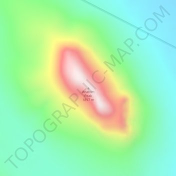
Name: Topografische Karte Anahim Peak, Höhe, Relief.
Durchschnittliche Höhe: 1.416 m
Minimale Höhe: 1.196 m
Maximale Höhe: 1.868 m
Spenden
Rüsten Sie sich für Ihr nächstes Abenteuer:
Als Amazon-Partner erhält diese Website eine Provision für qualifizierte Käufe, ohne zusätzliche Kosten für Sie.
Andere topografische Karten
Klicken Sie auf eine Karte, um ihre Topografie, ihre Höhe und ihr Relief anzuzeigen.
Kondor Lake
Canada > British Columbia > Cariboo Regional District > Area J (West Chilcotin)
Durchschnittliche Höhe: 1.718 m
Nimpo Lake
Canada > British Columbia > Cariboo Regional District > Area J (West Chilcotin)
Nimpo Lake is the jumping off point to the wilderness, much of it inaccessible to people except by floatplane or on foot. You can go flightseeing over Hunlen Falls, the third longest freefalling waterfall in Canada, or fly over the multicolored Rainbow Mountains or Monarch Mountain and see the pristine…
Durchschnittliche Höhe: 1.150 m
Tŝilhqox Biny (Chilko Lake)
Canada > British Columbia > Cariboo Regional District > Area J (West Chilcotin)
Tŝilhqox Biny (Pronounced: Tsyle-koh Bee), known as Chilko Lake, is a 180 km2 lake in west-central British Columbia, at the head of the Chilko River on the Chilcotin Plateau. The lake is about 65 km long, with a southwest arm 10 km long. It is one of the largest lakes by volume in the province because of its…
Durchschnittliche Höhe: 1.739 m
Nimpo Lake
Canada > British Columbia > Cariboo Regional District > Area J (West Chilcotin)
Durchschnittliche Höhe: 1.131 m
Spenden
Rüsten Sie sich für Ihr nächstes Abenteuer:
Als Amazon-Partner erhält diese Website eine Provision für qualifizierte Käufe, ohne zusätzliche Kosten für Sie.
Tatla Lake
Canada > British Columbia > Cariboo Regional District > Area J (West Chilcotin)
Durchschnittliche Höhe: 1.080 m
Great Canyon
Canada > British Columbia > Cariboo Regional District > Area J (West Chilcotin)
Durchschnittliche Höhe: 1.220 m
Tŝilhqox Biny (Chilko Lake)
Canada > British Columbia > Cariboo Regional District > Area J (West Chilcotin)
Tŝilhqox Biny (Pronounced: Tsyle-koh Bee), known as Chilko Lake, is a 180 km2 lake in west-central British Columbia, at the head of the Chilko River on the Chilcotin Plateau. The lake is about 65 km long, with a southwest arm 10 km long. It is one of the largest lakes by volume in the province because of its…
Durchschnittliche Höhe: 1.739 m
Great Canyon
Canada > British Columbia > Cariboo Regional District > Area J (West Chilcotin)
Durchschnittliche Höhe: 1.220 m
Spenden
Rüsten Sie sich für Ihr nächstes Abenteuer:
Als Amazon-Partner erhält diese Website eine Provision für qualifizierte Käufe, ohne zusätzliche Kosten für Sie.
Map Glacier
Canada > British Columbia > Cariboo Regional District > Area J (West Chilcotin)
Durchschnittliche Höhe: 2.037 m