
Topografische Karte Pukanec
Interaktive Karte
Klicken Sie auf die Karte, um die Höhe anzuzeigen.
Pukanec
The village lies at an altitude of 354 metres and covers an area of 26.196 km2. It has a population of 2067 people. It is located near the Štiavnica Mountains, in the Sikenica river valley. It is located around 18 km northeast of Levice.
Über diese Karte
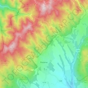
Name: Topografische Karte Pukanec, Höhe, Relief.
Durchschnittliche Höhe: 462 m
Minimale Höhe: 259 m
Maximale Höhe: 743 m