
Spenden
Rüsten Sie sich für Ihr nächstes Abenteuer:
Als Amazon-Partner erhält diese Website eine Provision für qualifizierte Käufe, ohne zusätzliche Kosten für Sie.
Topografische Karte Babina Greda
Klicken Sie auf die Karte, um die Höhe anzuzeigen.
Spenden
Rüsten Sie sich für Ihr nächstes Abenteuer:
Als Amazon-Partner erhält diese Website eine Provision für qualifizierte Käufe, ohne zusätzliche Kosten für Sie.
Über diese Karte
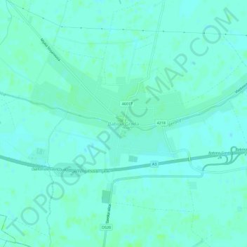
Name: Topografische Karte Babina Greda, Höhe, Relief.
Durchschnittliche Höhe: 84 m
Minimale Höhe: 81 m
Maximale Höhe: 90 m
Spenden
Rüsten Sie sich für Ihr nächstes Abenteuer:
Als Amazon-Partner erhält diese Website eine Provision für qualifizierte Käufe, ohne zusätzliche Kosten für Sie.
Andere topografische Karten
Klicken Sie auf eine Karte, um ihre Topografie, ihre Höhe und ihr Relief anzuzeigen.
Vukovar
Croatia > Vukovar-Srijem County
Vukovar is located 20 km (12 mi) northeast of Vinkovci and 36 km (22 mi) southeast of Osijek, with an elevation of 108 m (354 ft). Vukovar is located on the main road D2 Osijek—Vukovar—Ilok and on the Vinkovci—Vukovar railway (and road D55).
Durchschnittliche Höhe: 94 m
Spenden
Rüsten Sie sich für Ihr nächstes Abenteuer:
Als Amazon-Partner erhält diese Website eine Provision für qualifizierte Käufe, ohne zusätzliche Kosten für Sie.
Mjesni odbor "Mirkovci"
Croatia > Vukovar-Srijem County > Vinkovci
Mirkovci are bordering village between regions of Slavonia and Syrmia. Its elevation is 95 meters above the sea level. The village lies in a flatland north to the Bosut river. The village is connected with the rest of the country by the D46 state road connecting it with the town of Vinkovci and continuing into…
Durchschnittliche Höhe: 88 m
Spenden
Rüsten Sie sich für Ihr nächstes Abenteuer:
Als Amazon-Partner erhält diese Website eine Provision für qualifizierte Käufe, ohne zusätzliche Kosten für Sie.
Vukovar
Croatia > Vukovar-Srijem County
Vukovar is located 20 km (12 mi) northeast of Vinkovci and 36 km (22 mi) southeast of Osijek, with an elevation of 108 m (354 ft). Vukovar is located on the main road D2 Osijek—Vukovar—Ilok and on the Vinkovci—Vukovar railway (and road D55).
Durchschnittliche Höhe: 94 m
Spenden
Rüsten Sie sich für Ihr nächstes Abenteuer:
Als Amazon-Partner erhält diese Website eine Provision für qualifizierte Käufe, ohne zusätzliche Kosten für Sie.
Vinkovci
Croatia > Vukovar-Srijem County
Vinkovci is located in the eastern part of the Slavonia region, 19 km (12 mi) southwest of Vukovar, 24 km (15 mi) north of Županja and 43 km (27 mi) south of Osijek. The city lies in a flatland on the Bosut river, at an elevation of approx. 90 metres (300 ft), and has a mild continental climate. Vinkovci is…
Durchschnittliche Höhe: 88 m
Vukovar
Croatia > Vukovar-Srijem County
Vukovar is located 20 km (12 mi) northeast of Vinkovci and 36 km (22 mi) southeast of Osijek, with an elevation of 108 m (354 ft). Vukovar is located on the main road D2 Osijek—Vukovar—Ilok and on the Vinkovci—Vukovar railway (and road D55).
Durchschnittliche Höhe: 94 m