
Topografische Karte Ciudad Adolfo Lopez Mateos
Interaktive Karte
Klicken Sie auf die Karte, um die Höhe anzuzeigen.
Ciudad Adolfo Lopez Mateos
Its main elevations are Biznaga Hill, Atlaco Hill La Condesa Hill and Grande Hill.
Über diese Karte
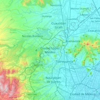
Name: Topografische Karte Ciudad Adolfo Lopez Mateos, Höhe, Relief.
Durchschnittliche Höhe: 2.426 m
Minimale Höhe: 2.222 m
Maximale Höhe: 3.514 m